
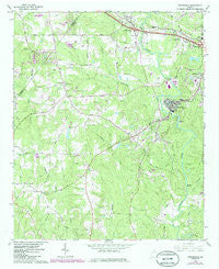
~ Porterdale GA topo map, 1:24000 scale, 7.5 X 7.5 Minute, Historical, 1964, updated 1985
Porterdale, Georgia, USGS topographic map dated 1964.
Includes geographic coordinates (latitude and longitude). This topographic map is suitable for hiking, camping, and exploring, or framing it as a wall map.
Printed on-demand using high resolution imagery, on heavy weight and acid free paper, or alternatively on a variety of synthetic materials.
Topos available on paper, Waterproof, Poly, or Tyvek. Usually shipping rolled, unless combined with other folded maps in one order.
- Product Number: USGS-5363528
- Free digital map download (high-resolution, GeoPDF): Porterdale, Georgia (file size: 13 MB)
- Map Size: please refer to the dimensions of the GeoPDF map above
- Weight (paper map): ca. 55 grams
- Map Type: POD USGS Topographic Map
- Map Series: HTMC
- Map Verison: Historical
- Cell ID: 36097
- Scan ID: 246673
- Imprint Year: 1985
- Woodland Tint: Yes
- Photo Revision Year: 1985
- Aerial Photo Year: 1981
- Edit Year: 1985
- Datum: NAD27
- Map Projection: Polyconic
- Map published by United States Geological Survey
- Map Language: English
- Scanner Resolution: 600 dpi
- Map Cell Name: Porterdale
- Grid size: 7.5 X 7.5 Minute
- Date on map: 1964
- Map Scale: 1:24000
- Geographical region: Georgia, United States
Neighboring Maps:
All neighboring USGS topo maps are available for sale online at a variety of scales.
Spatial coverage:
Topo map Porterdale, Georgia, covers the geographical area associated the following places:
- Twin Oaks - Hidden Shoals - Slades Mill - Abide Awhile - Country Acres Mobile Home Park - Riverbend Farms - Forest Lakes - Salem Cove - Woodland Acres - Forest Mill - Kirkland Acres - Porterdale - Oakbrook - Pace - Salem Place - Salem Ridge - Country Wood - Plum Orchard - Oak Forest Mobile Home Park - Buck Creek - Salem Branch - Springhill - Fountain Hill (historical) - Turkey Creek Estates - Fox Meadows - Lakeside - Rogers Heights - Brown Bridge Square - Fairview Commons - Country View - Fieldstone - Salem Village - Newton Woods - Oakwood - River North - Beaver Creek - Fairview - Brandy Shoals - Glynn Isles - Springfield - Country Terrace - Knights Landing - Millers Glen - Oak Hill Farms - Marble Valley - Village Green - Shoal Creek - Salem Meadows - Almon - Riverside Estates
- Map Area ID: AREA33.62533.5-84-83.875
- Northwest corner Lat/Long code: USGSNW33.625-84
- Northeast corner Lat/Long code: USGSNE33.625-83.875
- Southwest corner Lat/Long code: USGSSW33.5-84
- Southeast corner Lat/Long code: USGSSE33.5-83.875
- Northern map edge Latitude: 33.625
- Southern map edge Latitude: 33.5
- Western map edge Longitude: -84
- Eastern map edge Longitude: -83.875


