
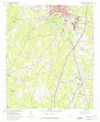
~ Newnan South GA topo map, 1:24000 scale, 7.5 X 7.5 Minute, Historical, 1965, updated 1974
Newnan South, Georgia, USGS topographic map dated 1965.
Includes geographic coordinates (latitude and longitude). This topographic map is suitable for hiking, camping, and exploring, or framing it as a wall map.
Printed on-demand using high resolution imagery, on heavy weight and acid free paper, or alternatively on a variety of synthetic materials.
Topos available on paper, Waterproof, Poly, or Tyvek. Usually shipping rolled, unless combined with other folded maps in one order.
- Product Number: USGS-5363224
- Free digital map download (high-resolution, GeoPDF): Newnan South, Georgia (file size: 11 MB)
- Map Size: please refer to the dimensions of the GeoPDF map above
- Weight (paper map): ca. 55 grams
- Map Type: POD USGS Topographic Map
- Map Series: HTMC
- Map Verison: Historical
- Cell ID: 71052
- Scan ID: 246502
- Imprint Year: 1974
- Woodland Tint: Yes
- Photo Revision Year: 1973
- Aerial Photo Year: 1973
- Datum: NAD27
- Map Projection: Polyconic
- Map published by United States Geological Survey
- Map Language: English
- Scanner Resolution: 600 dpi
- Map Cell Name: Newnan South
- Grid size: 7.5 X 7.5 Minute
- Date on map: 1965
- Map Scale: 1:24000
- Geographical region: Georgia, United States
Neighboring Maps:
All neighboring USGS topo maps are available for sale online at a variety of scales.
Spatial coverage:
Topo map Newnan South, Georgia, covers the geographical area associated the following places:
- Woodsmoke - Hearthstone Subdivision - Moreland - Quail Hollow Mobile Home Park - Smokey Acres - Stephens Crossroad - East Newnan - Pine Hills - Cureton Springs (historical) - Saint Charles - Cedar Trace - Smith City - Bohanon Crossroad - Oaklawn - Timberland Trail Subdivision
- Map Area ID: AREA33.37533.25-84.875-84.75
- Northwest corner Lat/Long code: USGSNW33.375-84.875
- Northeast corner Lat/Long code: USGSNE33.375-84.75
- Southwest corner Lat/Long code: USGSSW33.25-84.875
- Southeast corner Lat/Long code: USGSSE33.25-84.75
- Northern map edge Latitude: 33.375
- Southern map edge Latitude: 33.25
- Western map edge Longitude: -84.875
- Eastern map edge Longitude: -84.75


