
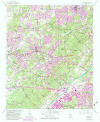
~ Mableton GA topo map, 1:24000 scale, 7.5 X 7.5 Minute, Historical, 1954, updated 1983
Mableton, Georgia, USGS topographic map dated 1954.
Includes geographic coordinates (latitude and longitude). This topographic map is suitable for hiking, camping, and exploring, or framing it as a wall map.
Printed on-demand using high resolution imagery, on heavy weight and acid free paper, or alternatively on a variety of synthetic materials.
Topos available on paper, Waterproof, Poly, or Tyvek. Usually shipping rolled, unless combined with other folded maps in one order.
- Product Number: USGS-5362780
- Free digital map download (high-resolution, GeoPDF): Mableton, Georgia (file size: 18 MB)
- Map Size: please refer to the dimensions of the GeoPDF map above
- Weight (paper map): ca. 55 grams
- Map Type: POD USGS Topographic Map
- Map Series: HTMC
- Map Verison: Historical
- Cell ID: 27091
- Scan ID: 246253
- Imprint Year: 1983
- Woodland Tint: Yes
- Photo Revision Year: 1982
- Aerial Photo Year: 1981
- Edit Year: 1982
- Datum: NAD27
- Map Projection: Polyconic
- Map published by United States Geological Survey
- Map Language: English
- Scanner Resolution: 600 dpi
- Map Cell Name: Mableton
- Grid size: 7.5 X 7.5 Minute
- Date on map: 1954
- Map Scale: 1:24000
- Geographical region: Georgia, United States
Neighboring Maps:
All neighboring USGS topo maps are available for sale online at a variety of scales.
Spatial coverage:
Topo map Mableton, Georgia, covers the geographical area associated the following places:
- Summit Ridge - Creelwood Trailer Park - Gardner Woods - Adamsville - Floyd - Whisperwoods - Ivy Point - Howard - Ivey Terrace - Cherokee Trail - Songwood - Vel Manor - Ford Heights - Knox Springs Estates - Gordon Heights - Boulder Vista - Oakhill - Brookside Village - Lodge West - Fairburn Heights - Flagstone - Nottingham - Carroll Heights - Mableton - James Acres - Pleasant Acres - Mount Pisgah Estates - Gordon Acres - Oak Hill - Ellison Estates - Saddleback Ridge - Sherwood Estates - Cardell - Normandy Forest - Hembree Hills - Witt Acres - Johnstons Crossing - Camerons Crossing - Brenda View - The Village Mobile Home Park - Lakeside - La Bama - Cheyenne Estates - Pine Creek - Pineview - Leland - Queens Lake Estates - Greenbrook - Dunn Hill - Blackhawk Hills - Gordon Hills Estates - Hillcrest Valley - Creelwood - Lizzie (historical) - Kennedy - Furniture City - Bankhead Courts - Pebblebrook Estates - Blue Ridge Manor - Pisgah Forest - Boulder Park - Castlewood Estates - Nickajack (historical) - Country Manor - Gordon Woods - Cherokee Hills - Quails Nest
- Map Area ID: AREA33.87533.75-84.625-84.5
- Northwest corner Lat/Long code: USGSNW33.875-84.625
- Northeast corner Lat/Long code: USGSNE33.875-84.5
- Southwest corner Lat/Long code: USGSSW33.75-84.625
- Southeast corner Lat/Long code: USGSSE33.75-84.5
- Northern map edge Latitude: 33.875
- Southern map edge Latitude: 33.75
- Western map edge Longitude: -84.625
- Eastern map edge Longitude: -84.5


