
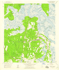
~ Harrietts Bluff GA topo map, 1:24000 scale, 7.5 X 7.5 Minute, Historical, 1958, updated 1959
Harrietts Bluff, Georgia, USGS topographic map dated 1958.
Includes geographic coordinates (latitude and longitude). This topographic map is suitable for hiking, camping, and exploring, or framing it as a wall map.
Printed on-demand using high resolution imagery, on heavy weight and acid free paper, or alternatively on a variety of synthetic materials.
Topos available on paper, Waterproof, Poly, or Tyvek. Usually shipping rolled, unless combined with other folded maps in one order.
- Product Number: USGS-5362076
- Free digital map download (high-resolution, GeoPDF): Harrietts Bluff, Georgia (file size: 11 MB)
- Map Size: please refer to the dimensions of the GeoPDF map above
- Weight (paper map): ca. 55 grams
- Map Type: POD USGS Topographic Map
- Map Series: HTMC
- Map Verison: Historical
- Cell ID: 19413
- Scan ID: 245863
- Imprint Year: 1959
- Woodland Tint: Yes
- Aerial Photo Year: 1957
- Survey Year: 1958
- Datum: NAD27
- Map Projection: Polyconic
- Map published by United States Geological Survey
- Map Language: English
- Scanner Resolution: 600 dpi
- Map Cell Name: Harrietts Bluff
- Grid size: 7.5 X 7.5 Minute
- Date on map: 1958
- Map Scale: 1:24000
- Geographical region: Georgia, United States
Neighboring Maps:
All neighboring USGS topo maps are available for sale online at a variety of scales.
Spatial coverage:
Topo map Harrietts Bluff, Georgia, covers the geographical area associated the following places:
- Highland Oaks - Mallard Pointe - Scotchville - Plantation Oaks - Admirals Walk - Village Oaks Mobile Home Park - River Oaks at Harrietts Bluff - London Hill - North River Marshes - Elliotts Plantation - Marianna (historical) - Lakemont Town Homes - Peter Point Oaks - Sadlers Cove - River Oaks - Harrietts Bluff - Sadlers Landing - Harbor Pines - Quail Hollow - Mariners Landing - Crooked River Plantation - Mission Trace - River Cove - North River Oaks - Palmas Realas - Elliotts Bluff - Foxwood - Sugar Mill Plantation
- Map Area ID: AREA30.87530.75-81.625-81.5
- Northwest corner Lat/Long code: USGSNW30.875-81.625
- Northeast corner Lat/Long code: USGSNE30.875-81.5
- Southwest corner Lat/Long code: USGSSW30.75-81.625
- Southeast corner Lat/Long code: USGSSE30.75-81.5
- Northern map edge Latitude: 30.875
- Southern map edge Latitude: 30.75
- Western map edge Longitude: -81.625
- Eastern map edge Longitude: -81.5


