
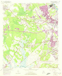
~ Garden City GA topo map, 1:24000 scale, 7.5 X 7.5 Minute, Historical, 1955, updated 1973
Garden City, Georgia, USGS topographic map dated 1955.
Includes geographic coordinates (latitude and longitude). This topographic map is suitable for hiking, camping, and exploring, or framing it as a wall map.
Printed on-demand using high resolution imagery, on heavy weight and acid free paper, or alternatively on a variety of synthetic materials.
Topos available on paper, Waterproof, Poly, or Tyvek. Usually shipping rolled, unless combined with other folded maps in one order.
- Product Number: USGS-5361884
- Free digital map download (high-resolution, GeoPDF): Garden City, Georgia (file size: 10 MB)
- Map Size: please refer to the dimensions of the GeoPDF map above
- Weight (paper map): ca. 55 grams
- Map Type: POD USGS Topographic Map
- Map Series: HTMC
- Map Verison: Historical
- Cell ID: 16783
- Scan ID: 245761
- Imprint Year: 1973
- Woodland Tint: Yes
- Photo Revision Year: 1971
- Aerial Photo Year: 1971
- Datum: NAD27
- Map Projection: Polyconic
- Map published by United States Geological Survey
- Map Language: English
- Scanner Resolution: 600 dpi
- Map Cell Name: Garden City
- Grid size: 7.5 X 7.5 Minute
- Date on map: 1955
- Map Scale: 1:24000
- Geographical region: Georgia, United States
Neighboring Maps:
All neighboring USGS topo maps are available for sale online at a variety of scales.
Spatial coverage:
Topo map Garden City, Georgia, covers the geographical area associated the following places:
- Pooler - Azalea Plaza Mobile Home Park - Southover - Garden City - Lamarville - Telfair Junction - Bachelors Mobile Home Park - Rossignol Hill - Liberty City - Mortons Mobile Home Park - Woodlawn Terrace - Colony Oaks Mobile Home Park - Cloverdale - Savannah Pines Mobile Home Park - Foss Mobile Home Park - Sharon Park - Central Junction - Wheat Hill - Silk Hope - Paradise Village Mobile Home Park - Starland Park - Grubbs - Shady Acres Mobile Home Court - Florida Junction - Ogeecheeton - Hamer - Alabama Junction - Tremont Park - Dean Forest Mobile Home Park - Richfield - Chatham City - Stanford Mobile Home Park - Woodville - Union Junction
- Map Area ID: AREA32.12532-81.25-81.125
- Northwest corner Lat/Long code: USGSNW32.125-81.25
- Northeast corner Lat/Long code: USGSNE32.125-81.125
- Southwest corner Lat/Long code: USGSSW32-81.25
- Southeast corner Lat/Long code: USGSSE32-81.125
- Northern map edge Latitude: 32.125
- Southern map edge Latitude: 32
- Western map edge Longitude: -81.25
- Eastern map edge Longitude: -81.125


