
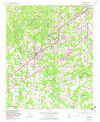
~ Fairburn GA topo map, 1:24000 scale, 7.5 X 7.5 Minute, Historical, 1954, updated 1983
Fairburn, Georgia, USGS topographic map dated 1954.
Includes geographic coordinates (latitude and longitude). This topographic map is suitable for hiking, camping, and exploring, or framing it as a wall map.
Printed on-demand using high resolution imagery, on heavy weight and acid free paper, or alternatively on a variety of synthetic materials.
Topos available on paper, Waterproof, Poly, or Tyvek. Usually shipping rolled, unless combined with other folded maps in one order.
- Product Number: USGS-5361736
- Free digital map download (high-resolution, GeoPDF): Fairburn, Georgia (file size: 13 MB)
- Map Size: please refer to the dimensions of the GeoPDF map above
- Weight (paper map): ca. 55 grams
- Map Type: POD USGS Topographic Map
- Map Series: HTMC
- Map Verison: Historical
- Cell ID: 14793
- Scan ID: 245680
- Imprint Year: 1983
- Woodland Tint: Yes
- Photo Revision Year: 1982
- Aerial Photo Year: 1981
- Edit Year: 1982
- Datum: NAD27
- Map Projection: Polyconic
- Map published by United States Geological Survey
- Map Language: English
- Scanner Resolution: 600 dpi
- Map Cell Name: Fairburn
- Grid size: 7.5 X 7.5 Minute
- Date on map: 1954
- Map Scale: 1:24000
- Geographical region: Georgia, United States
Neighboring Maps:
All neighboring USGS topo maps are available for sale online at a variety of scales.
Spatial coverage:
Topo map Fairburn, Georgia, covers the geographical area associated the following places:
- Gledstone Hills - The Woods - Union City - Shannon Villas - Bench Mark - Shannon Glen - Stonewall - Melanie Manor - Christian Corners - Brandon Hill - Wellington - Mallory Estates - Bethany - McClenney Estates - Shannon Chase - Lees Mill - Fife - Sandy Ridge Estates - Fairburn - Fireside - Rosegate Manor - Sunrise - Suffolk Downs - River Forest - Pine Acres Mobile Home Park - Muir Woods - Morning Creek Estates - Shandra Estates - Brogdon
- Map Area ID: AREA33.62533.5-84.625-84.5
- Northwest corner Lat/Long code: USGSNW33.625-84.625
- Northeast corner Lat/Long code: USGSNE33.625-84.5
- Southwest corner Lat/Long code: USGSSW33.5-84.625
- Southeast corner Lat/Long code: USGSSE33.5-84.5
- Northern map edge Latitude: 33.625
- Southern map edge Latitude: 33.5
- Western map edge Longitude: -84.625
- Eastern map edge Longitude: -84.5


