
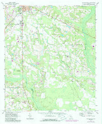
~ Douglas South GA topo map, 1:24000 scale, 7.5 X 7.5 Minute, Historical, 1971, updated 1987
Douglas South, Georgia, USGS topographic map dated 1971.
Includes geographic coordinates (latitude and longitude). This topographic map is suitable for hiking, camping, and exploring, or framing it as a wall map.
Printed on-demand using high resolution imagery, on heavy weight and acid free paper, or alternatively on a variety of synthetic materials.
Topos available on paper, Waterproof, Poly, or Tyvek. Usually shipping rolled, unless combined with other folded maps in one order.
- Product Number: USGS-5361546
- Free digital map download (high-resolution, GeoPDF): Douglas South, Georgia (file size: 11 MB)
- Map Size: please refer to the dimensions of the GeoPDF map above
- Weight (paper map): ca. 55 grams
- Map Type: POD USGS Topographic Map
- Map Series: HTMC
- Map Verison: Historical
- Cell ID: 12666
- Scan ID: 245576
- Imprint Year: 1987
- Woodland Tint: Yes
- Photo Revision Year: 1987
- Aerial Photo Year: 1983
- Edit Year: 1987
- Datum: NAD27
- Map Projection: Polyconic
- Map published by United States Geological Survey
- Map Language: English
- Scanner Resolution: 600 dpi
- Map Cell Name: Douglas South
- Grid size: 7.5 X 7.5 Minute
- Date on map: 1971
- Map Scale: 1:24000
- Geographical region: Georgia, United States
Neighboring Maps:
All neighboring USGS topo maps are available for sale online at a variety of scales.
Spatial coverage:
Topo map Douglas South, Georgia, covers the geographical area associated the following places:
- Hills Chapel - Tison Cemetery - Johnson Lake Dam North - Morman Cemetery - Johnson Lake - Franklin Cemetery - Harmony Grove Church - Douglas Municipal Airport - South Georgia College Department of Public Safety - Shiloh Missionary Baptist Church - Coffee Junior High School - Southwest Industrial Park - Douglas Fire Department Station 3 - Tanner Church - Wayfarer Church - Bell Lake Park - Everette Chapel Christian Methodist Episcopal Church - Georgia State Patrol Troop H Post 36 Douglas - Jowers Chapel - Satilla School - Haskin Lake Dam - William S Smith Library - First Assembly of God Church - Carver Church - Douglas Division - Ashley Yoemans Cemetery - Wayfare Cemetery - Coffee County Fire / Rescue Station 9 Green Acres - Pine Street Park - Haskin Lake - Pine Forests Memorial Gardens - Church of God (historical) - Harrel Grove Church - Carver Cemetery - Roundtree Center Park - Johnson Lake Dam - George Washington Carver High School (historical) - Pine Street Church of God - McClelland Cemetery - Harrell Grove Cemetery - Macedonia Baptist Church (historical) - Tanner Cemetery - Saints Temple Church of God in Christ - Franklin Church - Coffee County High School - South Georgia College - Johnson Lake North
- Map Area ID: AREA31.531.375-82.875-82.75
- Northwest corner Lat/Long code: USGSNW31.5-82.875
- Northeast corner Lat/Long code: USGSNE31.5-82.75
- Southwest corner Lat/Long code: USGSSW31.375-82.875
- Southeast corner Lat/Long code: USGSSE31.375-82.75
- Northern map edge Latitude: 31.5
- Southern map edge Latitude: 31.375
- Western map edge Longitude: -82.875
- Eastern map edge Longitude: -82.75


