
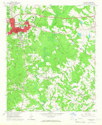
~ Covington GA topo map, 1:24000 scale, 7.5 X 7.5 Minute, Historical, 1964, updated 1966
Covington, Georgia, USGS topographic map dated 1964.
Includes geographic coordinates (latitude and longitude). This topographic map is suitable for hiking, camping, and exploring, or framing it as a wall map.
Printed on-demand using high resolution imagery, on heavy weight and acid free paper, or alternatively on a variety of synthetic materials.
Topos available on paper, Waterproof, Poly, or Tyvek. Usually shipping rolled, unless combined with other folded maps in one order.
- Product Number: USGS-5361270
- Free digital map download (high-resolution, GeoPDF): Covington, Georgia (file size: 10 MB)
- Map Size: please refer to the dimensions of the GeoPDF map above
- Weight (paper map): ca. 55 grams
- Map Type: POD USGS Topographic Map
- Map Series: HTMC
- Map Verison: Historical
- Cell ID: 10405
- Scan ID: 245418
- Imprint Year: 1966
- Woodland Tint: Yes
- Aerial Photo Year: 1962
- Field Check Year: 1964
- Datum: NAD27
- Map Projection: Polyconic
- Map published by United States Geological Survey
- Map Language: English
- Scanner Resolution: 600 dpi
- Map Cell Name: Covington
- Grid size: 7.5 X 7.5 Minute
- Date on map: 1964
- Map Scale: 1:24000
- Geographical region: Georgia, United States
Neighboring Maps:
All neighboring USGS topo maps are available for sale online at a variety of scales.
Spatial coverage:
Topo map Covington, Georgia, covers the geographical area associated the following places:
- Oxford - Meadowood Subdivision - Hidden Pines - Brookwood East - Hollow Hills - Hayston - Skyline - Ridgeway - Hidden Forest - Highpoint Mobile Home Park - Silver Lake - Oak Grove - Dixie - Mansfield Estates - Riverbend - Dixie Village - Meadowbrook Mobile Home Park - Bear Creek Estates - Hub Junction - Brentwood - Newton Ridge - Lassiter - Covington - Beacon Hill - Starrsville - Highpoint Forest - Settlers Grove - Jamestown - Newton Chase - Melody - Pine Valley Mobile Home Park - Dixie Acres - Cedar Creek - Deerfield - East Wood - Anderson Acres - Elk Ridge - High Point - Alcovy Mobile Home Park - Woodfield - Fairfield
- Map Area ID: AREA33.62533.5-83.875-83.75
- Northwest corner Lat/Long code: USGSNW33.625-83.875
- Northeast corner Lat/Long code: USGSNE33.625-83.75
- Southwest corner Lat/Long code: USGSSW33.5-83.875
- Southeast corner Lat/Long code: USGSSE33.5-83.75
- Northern map edge Latitude: 33.625
- Southern map edge Latitude: 33.5
- Western map edge Longitude: -83.875
- Eastern map edge Longitude: -83.75


