
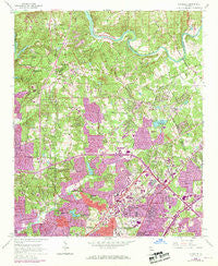
~ Chamblee GA topo map, 1:24000 scale, 7.5 X 7.5 Minute, Historical, 1954, updated 1969
Chamblee, Georgia, USGS topographic map dated 1954.
Includes geographic coordinates (latitude and longitude). This topographic map is suitable for hiking, camping, and exploring, or framing it as a wall map.
Printed on-demand using high resolution imagery, on heavy weight and acid free paper, or alternatively on a variety of synthetic materials.
Topos available on paper, Waterproof, Poly, or Tyvek. Usually shipping rolled, unless combined with other folded maps in one order.
- Product Number: USGS-5361048
- Free digital map download (high-resolution, GeoPDF): Chamblee, Georgia (file size: 18 MB)
- Map Size: please refer to the dimensions of the GeoPDF map above
- Weight (paper map): ca. 55 grams
- Map Type: POD USGS Topographic Map
- Map Series: HTMC
- Map Verison: Historical
- Cell ID: 8103
- Scan ID: 245288
- Imprint Year: 1969
- Woodland Tint: Yes
- Photo Revision Year: 1968
- Aerial Photo Year: 1968
- Datum: NAD27
- Map Projection: Polyconic
- Map published by United States Geological Survey
- Map Language: English
- Scanner Resolution: 600 dpi
- Map Cell Name: Chamblee
- Grid size: 7.5 X 7.5 Minute
- Date on map: 1954
- Map Scale: 1:24000
- Geographical region: Georgia, United States
Neighboring Maps:
All neighboring USGS topo maps are available for sale online at a variety of scales.
Spatial coverage:
Topo map Chamblee, Georgia, covers the geographical area associated the following places:
- Cambridge Square - Trailridge - Starlight Hills - Chestnut Forest - Spalding Hills - Huntley Hill - Derby Hill - Dunwoody Corners - DeKalb Highlands - Saint Andrews - Elton Estates - Redfield - Hammond - Dunwoody - Elmside Village - Four Oaks - Westover - North Point - Crestwicke - Windwood - Lake Villas - Chamblee - Dunwoody Club Forest - Fox Hollow - Windhaven - Meadowlake - Berwicke - Oak Point - Highpoint Forest - Mill Glen - Manning Farms - Humphries (historical) - Sara Lake Estates - Hidden Branches - Forestdale Estates - Chattahoochee Station - Horseshoe Bend - Village Mill - Wynterhall - Waterford - Littlebrooke Farm - Village North - Springfield - Valley View - Mount Vernon Springs - Shenandoah - Neely Farm - Fontainbleau Forest - Forest Valley - Wickford - Verdon Forest - Dunwoody Heights - Embry Hills - Withmere - Chelsea Park - Rivergate - Dunwoody West - Northwoods - Cambridge Estates - Deerfield - Windsor Heights - Peachtree - Brookhaven - Lockridge Forest - Riversong - Happy Hollow - Fouts Corner - Doraville - Fairfield - River Bluff - Mount Vernon Lake - Ridgeview Forest - Buchanan (historical) - Dunwoody Knoll - North Peachtree Woods - Windsor at Peachtree
- Map Area ID: AREA3433.875-84.375-84.25
- Northwest corner Lat/Long code: USGSNW34-84.375
- Northeast corner Lat/Long code: USGSNE34-84.25
- Southwest corner Lat/Long code: USGSSW33.875-84.375
- Southeast corner Lat/Long code: USGSSE33.875-84.25
- Northern map edge Latitude: 34
- Southern map edge Latitude: 33.875
- Western map edge Longitude: -84.375
- Eastern map edge Longitude: -84.25


