
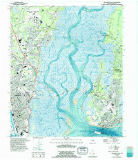
~ Brunswick East GA topo map, 1:24000 scale, 7.5 X 7.5 Minute, Historical, 1993, updated 1995
Brunswick East, Georgia, USGS topographic map dated 1993.
Includes geographic coordinates (latitude and longitude). This topographic map is suitable for hiking, camping, and exploring, or framing it as a wall map.
Printed on-demand using high resolution imagery, on heavy weight and acid free paper, or alternatively on a variety of synthetic materials.
Topos available on paper, Waterproof, Poly, or Tyvek. Usually shipping rolled, unless combined with other folded maps in one order.
- Product Number: USGS-5360794
- Free digital map download (high-resolution, GeoPDF): Brunswick East, Georgia (file size: 18 MB)
- Map Size: please refer to the dimensions of the GeoPDF map above
- Weight (paper map): ca. 55 grams
- Map Type: POD USGS Topographic Map
- Map Series: HTMC
- Map Verison: Historical
- Cell ID: 5802
- Scan ID: 245135
- Imprint Year: 1995
- Woodland Tint: Yes
- Aerial Photo Year: 1993
- Edit Year: 1995
- Field Check Year: 1993
- Datum: NAD27
- Map Projection: Universal Transverse Mercator
- Map published by United States Geological Survey
- Map Language: English
- Scanner Resolution: 600 dpi
- Map Cell Name: Brunswick East
- Grid size: 7.5 X 7.5 Minute
- Date on map: 1993
- Map Scale: 1:24000
- Geographical region: Georgia, United States
Neighboring Maps:
All neighboring USGS topo maps are available for sale online at a variety of scales.
Spatial coverage:
Topo map Brunswick East, Georgia, covers the geographical area associated the following places:
- Island View - Wymberly-On-The-Marsh - Oglethorpe Park - Country Club Park - Riverview - Youngwood - Kensington Park - Central Park - Transvilla Mobile Home Park - Belle Point Estates - Saint Clair Estates - Silver Lake - Azalea Gardens - Gordon Oaks Homes - Brunswick - Glynnvilla - Waverly Pines Park - Bel Air - Island Retreat - Windward Acres - Jewtown - Blackbanks - Kinstle - East End - Kelvin Grove - McIntyre Court - Druid Oaks Mobile Home Park - Mallory Park - Cabana Court Mobile Home Park - Ebo Landing - Pine Forest - Back Landing - Glynco Annex - Kings Terrace - Devenwood - Golf Retreat - The Meadows - Suburban Estates - Wesley Oaks - Saint Simon Mills - Glynn Haven - Saint Simons - Riverside - Beverly Shores - Demere Hammock - Demere Park - Country Club Estates - Saint Simons Heights - Fairway Oaks - College Park - El Dorado - Brunswick Villa - Druid Oaks - Epworth Acres - Cypress Mills - Pineview - King City - Thornhill Mobile Home Park - Magnolia Park
- Map Area ID: AREA31.2531.125-81.5-81.375
- Northwest corner Lat/Long code: USGSNW31.25-81.5
- Northeast corner Lat/Long code: USGSNE31.25-81.375
- Southwest corner Lat/Long code: USGSSW31.125-81.5
- Southeast corner Lat/Long code: USGSSE31.125-81.375
- Northern map edge Latitude: 31.25
- Southern map edge Latitude: 31.125
- Western map edge Longitude: -81.5
- Eastern map edge Longitude: -81.375


