
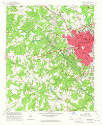
~ Athens West GA topo map, 1:24000 scale, 7.5 X 7.5 Minute, Historical, 1964, updated 1967
Athens West, Georgia, USGS topographic map dated 1964.
Includes geographic coordinates (latitude and longitude). This topographic map is suitable for hiking, camping, and exploring, or framing it as a wall map.
Printed on-demand using high resolution imagery, on heavy weight and acid free paper, or alternatively on a variety of synthetic materials.
Topos available on paper, Waterproof, Poly, or Tyvek. Usually shipping rolled, unless combined with other folded maps in one order.
- Product Number: USGS-5360434
- Free digital map download (high-resolution, GeoPDF): Athens West, Georgia (file size: 12 MB)
- Map Size: please refer to the dimensions of the GeoPDF map above
- Weight (paper map): ca. 55 grams
- Map Type: POD USGS Topographic Map
- Map Series: HTMC
- Map Verison: Historical
- Cell ID: 1754
- Scan ID: 244938
- Imprint Year: 1967
- Woodland Tint: Yes
- Aerial Photo Year: 1962
- Field Check Year: 1964
- Datum: NAD27
- Map Projection: Polyconic
- Map published by United States Geological Survey
- Map Language: English
- Scanner Resolution: 600 dpi
- Map Cell Name: Athens West
- Grid size: 7.5 X 7.5 Minute
- Date on map: 1964
- Map Scale: 1:24000
- Geographical region: Georgia, United States
Neighboring Maps:
All neighboring USGS topo maps are available for sale online at a variety of scales.
Spatial coverage:
Topo map Athens West, Georgia, covers the geographical area associated the following places:
- Berkley Hills - Bel Air Heights - Princeton - Jennings Mill - McDonald - Oconee Heights - North Valley - Westchester - Echo Brook Park - Sedgefield - Jefferson Valley - Park View Homes - Georgian Hills - Hanover - Quailwood - Homes of Mansfield - Fieldstone - Stonehenge - Sherwood Forest - Danson Woods - Chadds Walk - Riverhaven Estates - Ivywood - Elder - Glenwood - Fairfield - Rebel Hill - Moss Side - Spartan Lane - Huntington Park - Cobbham (historical) - Northridge Park - McNutt Creek - Tee Pee - Briar Lakes - Beverly Heights - Garden Hills - Oak Ridge - Pinecrest Hills - Woodridge North - Windy Hill - North Place - Inverness Farms - Westwood Hills - Kingswood - Bedgood - Athens - Rollingwood - Summit Grove - Westgate Park - Crystal Hills - Pine Lake - Woodland Hills - Lake Forest - Tanglewood - Britain Estates - Creekwood Estates - Tanglebrook - Sagamore Hills - Camelot - Northwest Woods - Timothy Estates - Canyon Creek - Homewood Hills - Homewood Hills - Birchmore - Tallassee Estates - Knottingham - Stonebridge - Tara Way - Hickory Hill - Woodhaven High Ridge - Country Club Estates - Indian Hills - Skyline Park - Beechwood Hills - Tallassee Farms - Glen Oaks - Highland Oaks - Den Court - Holly Hills - Ramble Hills - Daniel Plantation - Windy Creek - Pine Forest - Davis Estates - Epps Bridge Crossing - Forest Heights - Barber Creek Estates - Holiday Estates - Swanson - Overlook Village - Riverside Hills - Brookwood Estates - Adams - Riverside - Broadacres Homes - Rushwood - Woodlands - Ben Dowdy
- Map Area ID: AREA3433.875-83.5-83.375
- Northwest corner Lat/Long code: USGSNW34-83.5
- Northeast corner Lat/Long code: USGSNE34-83.375
- Southwest corner Lat/Long code: USGSSW33.875-83.5
- Southeast corner Lat/Long code: USGSSE33.875-83.375
- Northern map edge Latitude: 34
- Southern map edge Latitude: 33.875
- Western map edge Longitude: -83.5
- Eastern map edge Longitude: -83.375


