
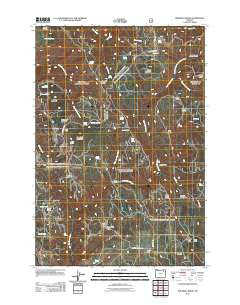
~ Drumhill Ridge OR topo map, 1:24000 scale, 7.5 X 7.5 Minute, Historical, 2011
Drumhill Ridge, Oregon, USGS topographic map dated 2011.
Includes geographic coordinates (latitude and longitude). This topographic map is suitable for hiking, camping, and exploring, or framing it as a wall map.
Printed on-demand using high resolution imagery, on heavy weight and acid free paper, or alternatively on a variety of synthetic materials.
Topos available on paper, Waterproof, Poly, or Tyvek. Usually shipping rolled, unless combined with other folded maps in one order.
- Product Number: USGS-5360234
- Free digital map download (high-resolution, GeoPDF): Drumhill Ridge, Oregon (file size: 25 MB)
- Map Size: please refer to the dimensions of the GeoPDF map above
- Weight (paper map): ca. 55 grams
- Map Type: POD USGS Topographic Map
- Map Series: US Topo
- Map Verison: Historical
- Cell ID: 12811
- Datum: North American Datum of 1983
- Map Projection: Transverse Mercator
- Map Cell Name: Drumhill Ridge
- Grid size: 7.5 X 7.5 Minute
- Date on map: 2011
- Map Scale: 1:24000
- Geographical region: Oregon, United States
Neighboring Maps:
All neighboring USGS topo maps are available for sale online at a variety of scales.
Spatial coverage:
Topo map Drumhill Ridge, Oregon, covers the geographical area associated the following places:
- Rock Spring - Tie Spring - Y Ridge - Hoskins Spring - Hugh Spring - Daniel Spring - Dollar Spring - Rocky Flat - Herron Ridge - Little John Day Creek - Summit Mount Emily Trail - Burnt Canyon - Camp One - Dixie Flat - Long Pond - North Flat Spring - Walker Spring - Indian Spring - Three Cabin Ridge - Tie Camp Spring - Fox Hill - Yarn Spring - Green Mountain - Telephone Ridge - Fiddlers Hell - End Spring - Sugarloaf Mountain - Camp Three - Kellers Cabin - Smith Ridge - Mount Emily Creek - Weed Spring - Sacajawea Spring - Tie Creek - Lewis Spring - Knob Creek - Allen Spring - Simerson Spring - Long Ridge - Horse Ridge - Deer Lick Spring - Middle Fork Mount Emily Creek - S S Spring - Mouse Spring - Standfield Meadow - Cantrell Spring - Summit Spring - Spring Mountain - Summit Guard Station - Carters Hog Ridge - Five Points Trail - Drumhill Ridge
- Map Area ID: AREA45.545.375-118.25-118.125
- Northwest corner Lat/Long code: USGSNW45.5-118.25
- Northeast corner Lat/Long code: USGSNE45.5-118.125
- Southwest corner Lat/Long code: USGSSW45.375-118.25
- Southeast corner Lat/Long code: USGSSE45.375-118.125
- Northern map edge Latitude: 45.5
- Southern map edge Latitude: 45.375
- Western map edge Longitude: -118.25
- Eastern map edge Longitude: -118.125


