
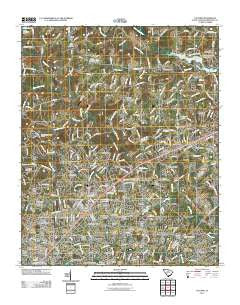
~ Taylors SC topo map, 1:24000 scale, 7.5 X 7.5 Minute, Historical, 2011
Taylors, South Carolina, USGS topographic map dated 2011.
Includes geographic coordinates (latitude and longitude). This topographic map is suitable for hiking, camping, and exploring, or framing it as a wall map.
Printed on-demand using high resolution imagery, on heavy weight and acid free paper, or alternatively on a variety of synthetic materials.
Topos available on paper, Waterproof, Poly, or Tyvek. Usually shipping rolled, unless combined with other folded maps in one order.
- Product Number: USGS-5360151
- Free digital map download (high-resolution, GeoPDF): Taylors, South Carolina (file size: 25 MB)
- Map Size: please refer to the dimensions of the GeoPDF map above
- Weight (paper map): ca. 55 grams
- Map Type: POD USGS Topographic Map
- Map Series: US Topo
- Map Verison: Historical
- Cell ID: 44399
- Datum: North American Datum of 1983
- Map Projection: Transverse Mercator
- Map Cell Name: Taylors
- Grid size: 7.5 X 7.5 Minute
- Date on map: 2011
- Map Scale: 1:24000
- Geographical region: South Carolina, United States
Neighboring Maps:
All neighboring USGS topo maps are available for sale online at a variety of scales.
Spatial coverage:
Topo map Taylors, South Carolina, covers the geographical area associated the following places:
- Bellwood Estates - Sugar Mill - Hermitage Hills - Silver Leaf - Sugar Creek Villas - Hampton Heights - Green Hills - Belmont Heights - Dellwood - Old Mill Estates - North Side Heights - Sandy Flat - Morningside - Suber - Edwards Forest Heights - Peppertree - White Oak - Creekside Villas - Willington Green - Stone Lake Heights - Thornwood - Cunningham Acres - Oak Hollow - Pine Knott Forest - Pebble Creek - Forest View - Walden Pond - Brookwood Forest - Pinehaven Acres - Piney Ridge - Del Norte - Taylors - Thornwood Acres - Kings (historical) - Broadleaf Acres - Jamestown Estates - Paris (historical) - McSwain Gardens - Colonial Hills - Wade Hampton Gardens - Colony Subdivision - Mount Vernon Estates - Homestead Acres - Del Norte Estates - Rosedale - East Gate Village - Enoree Hills - Gilstrap Heights - Riverdowns - Oak View - Piedmont Park - Dell Vista Heights - Valley Haven - Willow Heights - Liberty Park - Orchard Acres - Northwood - Sugar Creek - Wildaire - Spring Forest - Pinewood Estates - Cane Brake - Broadmoor - Cannon Hills - King Acres - Lorena Park - Wade Hampton - Green Forest - Chick Springs - Forestdale Heights - Cherokee Forest - The Meadows - Grey Fox Run - Minter - Nursery (historical) - Milford - Groveland Dell - Botany Woods - Kingsgate - Fairview - Windsor Oaks - North Acres - Seven Oaks - Sylvan Hills - Bird Fields - Shady Creek - Burgiss Hills - Laurel Hills
- Map Area ID: AREA3534.875-82.375-82.25
- Northwest corner Lat/Long code: USGSNW35-82.375
- Northeast corner Lat/Long code: USGSNE35-82.25
- Southwest corner Lat/Long code: USGSSW34.875-82.375
- Southeast corner Lat/Long code: USGSSE34.875-82.25
- Northern map edge Latitude: 35
- Southern map edge Latitude: 34.875
- Western map edge Longitude: -82.375
- Eastern map edge Longitude: -82.25


