
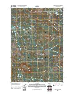
~ Green Mountain OR topo map, 1:24000 scale, 7.5 X 7.5 Minute, Historical, 2011
Green Mountain, Oregon, USGS topographic map dated 2011.
Includes geographic coordinates (latitude and longitude). This topographic map is suitable for hiking, camping, and exploring, or framing it as a wall map.
Printed on-demand using high resolution imagery, on heavy weight and acid free paper, or alternatively on a variety of synthetic materials.
Topos available on paper, Waterproof, Poly, or Tyvek. Usually shipping rolled, unless combined with other folded maps in one order.
- Product Number: USGS-5359995
- Free digital map download (high-resolution, GeoPDF): Green Mountain, Oregon (file size: 25 MB)
- Map Size: please refer to the dimensions of the GeoPDF map above
- Weight (paper map): ca. 55 grams
- Map Type: POD USGS Topographic Map
- Map Series: US Topo
- Map Verison: Historical
- Cell ID: 18339
- Datum: North American Datum of 1983
- Map Projection: Transverse Mercator
- Map Cell Name: Green Mountain
- Grid size: 7.5 X 7.5 Minute
- Date on map: 2011
- Map Scale: 1:24000
- Geographical region: Oregon, United States
Neighboring Maps:
All neighboring USGS topo maps are available for sale online at a variety of scales.
Spatial coverage:
Topo map Green Mountain, Oregon, covers the geographical area associated the following places:
- John Day Creek - South Fork Youngs River - North Fork Klaskanine River - Fox Creek - Olney G S - Green Mountain - Glazers Grade - Estoos - Bear Creek Dam - Astoria Water Treatment Plant - Rock Creek - Middle Fork North Fork Klaskanine River - Osgood Creek - Waterworks Creek - Klaskanine Fish Hatchery - Nobel Ridge Farm - Barth Falls - North Fork North Fork Klaskanine River - Lilleas - Perkins Creek - Sigfredson County Park - South Fork Klaskanine River - Klaskanine Summit - Clatsop County - Snow Point - Bear Creek Reservoir
- Map Area ID: AREA46.12546-123.75-123.625
- Northwest corner Lat/Long code: USGSNW46.125-123.75
- Northeast corner Lat/Long code: USGSNE46.125-123.625
- Southwest corner Lat/Long code: USGSSW46-123.75
- Southeast corner Lat/Long code: USGSSE46-123.625
- Northern map edge Latitude: 46.125
- Southern map edge Latitude: 46
- Western map edge Longitude: -123.75
- Eastern map edge Longitude: -123.625


