
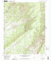
~ X Lazy F Ranch CO topo map, 1:24000 scale, 7.5 X 7.5 Minute, Historical, 1957, updated 1987
X Lazy F Ranch, Colorado, USGS topographic map dated 1957.
Includes geographic coordinates (latitude and longitude). This topographic map is suitable for hiking, camping, and exploring, or framing it as a wall map.
Printed on-demand using high resolution imagery, on heavy weight and acid free paper, or alternatively on a variety of synthetic materials.
Topos available on paper, Waterproof, Poly, or Tyvek. Usually shipping rolled, unless combined with other folded maps in one order.
- Product Number: USGS-5357851
- Free digital map download (high-resolution, GeoPDF): X Lazy F Ranch, Colorado (file size: 14 MB)
- Map Size: please refer to the dimensions of the GeoPDF map above
- Weight (paper map): ca. 55 grams
- Map Type: POD USGS Topographic Map
- Map Series: HTMC
- Map Verison: Historical
- Cell ID: 49987
- Scan ID: 234979
- Imprint Year: 1987
- Woodland Tint: Yes
- Visual Version Number: 2
- Aerial Photo Year: 1955
- Field Check Year: 1957
- Datum: NAD27
- Map Projection: Polyconic
- Map published by United States Geological Survey
- Map Language: English
- Scanner Resolution: 600 dpi
- Map Cell Name: X Lazy F Ranch
- Grid size: 7.5 X 7.5 Minute
- Date on map: 1957
- Map Scale: 1:24000
- Geographical region: Colorado, United States
Neighboring Maps:
All neighboring USGS topo maps are available for sale online at a variety of scales.
Spatial coverage:
Topo map X Lazy F Ranch, Colorado, covers the geographical area associated the following places:
- Castle Number 1 Dam - Powell Ridge - East Crystal Creek - North Dyer Creek - Ferrier Ridge - Mill Creek - Castle Reservoir Number 3 - Allen Pond - X Lazy F Ranch - Castle Number 3 Dam - South Crystal Creek - Hartman Trail - Left Hand Corral Creek - Castle Reservoir Number 1 - Crystal Creek Forest Service Station - Grand View Ditch - Childress Cow Camp - South Dyer Creek - Mesa Creek Ditch - Blue Lake - Black Mesa Work Center - Dyer Creek - West Dyer Creek
- Map Area ID: AREA38.62538.5-107.5-107.375
- Northwest corner Lat/Long code: USGSNW38.625-107.5
- Northeast corner Lat/Long code: USGSNE38.625-107.375
- Southwest corner Lat/Long code: USGSSW38.5-107.5
- Southeast corner Lat/Long code: USGSSE38.5-107.375
- Northern map edge Latitude: 38.625
- Southern map edge Latitude: 38.5
- Western map edge Longitude: -107.5
- Eastern map edge Longitude: -107.375


