
~ Trail Mountain CO topo map, 1:24000 scale, 7.5 X 7.5 Minute, Historical, 1957, updated 1963
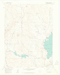
Trail Mountain, Colorado, USGS topographic map dated 1957.
Includes geographic coordinates (latitude and longitude). This topographic map is suitable for hiking, camping, and exploring, or framing it as a wall map.
Printed on-demand using high resolution imagery, on heavy weight and acid free paper, or alternatively on a variety of synthetic materials.
Topos available on paper, Waterproof, Poly, or Tyvek. Usually shipping rolled, unless combined with other folded maps in one order.
- Product Number: USGS-5356931
- Free digital map download (high-resolution, GeoPDF): Trail Mountain, Colorado (file size: 6 MB)
- Map Size: please refer to the dimensions of the GeoPDF map above
- Weight (paper map): ca. 55 grams
- Map Type: POD USGS Topographic Map
- Map Series: HTMC
- Map Verison: Historical
- Cell ID: 45552
- Scan ID: 402013
- Imprint Year: 1963
- Visual Version Number: 2
- Aerial Photo Year: 1953
- Field Check Year: 1957
- Datum: NAD27
- Map Projection: Polyconic
- Map published by United States Geological Survey
- Map Language: English
- Scanner Resolution: 508 dpi
- Map Cell Name: Trail Mountain
- Grid size: 7.5 X 7.5 Minute
- Date on map: 1957
- Map Scale: 1:24000
- Geographical region: Colorado, United States
Neighboring Maps:
All neighboring USGS topo maps are available for sale online at a variety of scales.
Spatial coverage:
Topo map Trail Mountain, Colorado, covers the geographical area associated the following places:
- Stillwater Creek - Red Top Valley Ditch - Quinette Point Picnic Area - Rainbow Bay - Willow Creek Dam - Koerber Ditch - Johnson Ditch - Willow Creek Campground - Miller Hereford Ranch - Apiatan Mountain - Cutthroat Trout Bay - Rainbow Bay Picnic Area - Granby Dikes Number 1, 2, and 4 Dam - Willow Creek Boat Ramp - Table Mountain - C Lazy U Ranch - Chester Ditch - Soda Spring - Kokanee Cove - Bunte Dam - Willow Creek Canal Picnic Area - Trail Mountain - Sunset Point Picnic Area - Granby Pumping Plant - Soda Creek - Lochleven Cove - Willow Creek Pump Canal - Willow Creek Reservoir - Bunte Reservoir - Trail Creek - Sunset Point Boat Ramp - Slash J Slash Ranch - Fish Bay
- Map Area ID: AREA40.2540.125-106-105.875
- Northwest corner Lat/Long code: USGSNW40.25-106
- Northeast corner Lat/Long code: USGSNE40.25-105.875
- Southwest corner Lat/Long code: USGSSW40.125-106
- Southeast corner Lat/Long code: USGSSE40.125-105.875
- Northern map edge Latitude: 40.25
- Southern map edge Latitude: 40.125
- Western map edge Longitude: -106
- Eastern map edge Longitude: -105.875


