
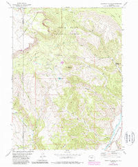
~ Sugarloaf Mountain CO topo map, 1:24000 scale, 7.5 X 7.5 Minute, Historical, 1977, updated 1988
Sugarloaf Mountain, Colorado, USGS topographic map dated 1977.
Includes geographic coordinates (latitude and longitude). This topographic map is suitable for hiking, camping, and exploring, or framing it as a wall map.
Printed on-demand using high resolution imagery, on heavy weight and acid free paper, or alternatively on a variety of synthetic materials.
Topos available on paper, Waterproof, Poly, or Tyvek. Usually shipping rolled, unless combined with other folded maps in one order.
- Product Number: USGS-5356509
- Free digital map download (high-resolution, GeoPDF): Sugarloaf Mountain, Colorado (file size: 14 MB)
- Map Size: please refer to the dimensions of the GeoPDF map above
- Weight (paper map): ca. 55 grams
- Map Type: POD USGS Topographic Map
- Map Series: HTMC
- Map Verison: Historical
- Cell ID: 43649
- Scan ID: 234631
- Imprint Year: 1988
- Woodland Tint: Yes
- Photo Revision Year: 1987
- Aerial Photo Year: 1983
- Edit Year: 1987
- Field Check Year: 1974
- Datum: NAD27
- Map Projection: Lambert Conformal Conic
- Map published by United States Geological Survey
- Map Language: English
- Scanner Resolution: 600 dpi
- Map Cell Name: Sugarloaf Mountain
- Grid size: 7.5 X 7.5 Minute
- Date on map: 1977
- Map Scale: 1:24000
- Geographical region: Colorado, United States
Neighboring Maps:
All neighboring USGS topo maps are available for sale online at a variety of scales.
Spatial coverage:
Topo map Sugarloaf Mountain, Colorado, covers the geographical area associated the following places:
- Mason Creek - Willow Lake - Riland Community Center - Hidden Spring Dam - East Fork Sheep Creek - Trail Gulch - Range - West Fork Red Dirt Creek - Morris Creek - Horse Lake - Hidden Spring Reservoir - Dotsero Wildlife Area - Buck Lake - East Fork Red Dirt Creek - Big Spring - Little Sugarloaf Mountain - Porphyry Mountain - West Fork Sheep Creek - Sugarloaf Mountain - Horse Creek - Natural Bridge - Willow Creek
- Map Area ID: AREA39.87539.75-107.125-107
- Northwest corner Lat/Long code: USGSNW39.875-107.125
- Northeast corner Lat/Long code: USGSNE39.875-107
- Southwest corner Lat/Long code: USGSSW39.75-107.125
- Southeast corner Lat/Long code: USGSSE39.75-107
- Northern map edge Latitude: 39.875
- Southern map edge Latitude: 39.75
- Western map edge Longitude: -107.125
- Eastern map edge Longitude: -107


