
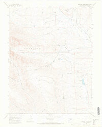
~ Squirrel Creek CO topo map, 1:24000 scale, 7.5 X 7.5 Minute, Historical, 1965, updated 1968
Squirrel Creek, Colorado, USGS topographic map dated 1965.
Includes geographic coordinates (latitude and longitude). This topographic map is suitable for hiking, camping, and exploring, or framing it as a wall map.
Printed on-demand using high resolution imagery, on heavy weight and acid free paper, or alternatively on a variety of synthetic materials.
Topos available on paper, Waterproof, Poly, or Tyvek. Usually shipping rolled, unless combined with other folded maps in one order.
- Product Number: USGS-5356315
- Free digital map download (high-resolution, GeoPDF): Squirrel Creek, Colorado (file size: 6 MB)
- Map Size: please refer to the dimensions of the GeoPDF map above
- Weight (paper map): ca. 55 grams
- Map Type: POD USGS Topographic Map
- Map Series: HTMC
- Map Verison: Historical
- Cell ID: 42799
- Scan ID: 402194
- Imprint Year: 1968
- Visual Version Number: 2
- Aerial Photo Year: 1964
- Field Check Year: 1965
- Datum: NAD27
- Map Projection: Polyconic
- Map published by United States Geological Survey
- Map Language: English
- Scanner Resolution: 508 dpi
- Map Cell Name: Squirrel Creek
- Grid size: 7.5 X 7.5 Minute
- Date on map: 1965
- Map Scale: 1:24000
- Geographical region: Colorado, United States
Neighboring Maps:
All neighboring USGS topo maps are available for sale online at a variety of scales.
Spatial coverage:
Topo map Squirrel Creek, Colorado, covers the geographical area associated the following places:
- Smith Mine - Ohio Creek Number Two Mine - Judy North Highline Ditch - Baldwin Star Mine - Castleton Ditch - Farnum Gulch - Mill Creek - Eilebrecht Ditch Number 1 - Hope Resich Ditch - Cunningham Reservoir - The Pie - Cunningham Lake - Clay Gulch - Stratman Ditch - Little Mill Creek Ditch - Highline Ditch - Ohio Creek Mine - Hinkle Mine - Campbell Ditch - Little Mill Creek - Middle Beaver Creek - Grays Gulch - Ohio Mine - Baler Gulch - Lowline Trail - Middle Creek - Carbon Creek - Gunnison County - Willow Creek - Acme Ditch - Sunbeam Mine - Price Creek - Kenny Moore Reservoir - Squirrel Creek - Kenny Moore Dam
- Map Area ID: AREA38.7538.625-107.125-107
- Northwest corner Lat/Long code: USGSNW38.75-107.125
- Northeast corner Lat/Long code: USGSNE38.75-107
- Southwest corner Lat/Long code: USGSSW38.625-107.125
- Southeast corner Lat/Long code: USGSSE38.625-107
- Northern map edge Latitude: 38.75
- Southern map edge Latitude: 38.625
- Western map edge Longitude: -107.125
- Eastern map edge Longitude: -107


