
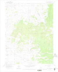
~ Razor Creek Dome CO topo map, 1:24000 scale, 7.5 X 7.5 Minute, Historical, 1962, updated 1974
Razor Creek Dome, Colorado, USGS topographic map dated 1962.
Includes geographic coordinates (latitude and longitude). This topographic map is suitable for hiking, camping, and exploring, or framing it as a wall map.
Printed on-demand using high resolution imagery, on heavy weight and acid free paper, or alternatively on a variety of synthetic materials.
Topos available on paper, Waterproof, Poly, or Tyvek. Usually shipping rolled, unless combined with other folded maps in one order.
- Product Number: USGS-5355123
- Free digital map download (high-resolution, GeoPDF): Razor Creek Dome, Colorado (file size: 6 MB)
- Map Size: please refer to the dimensions of the GeoPDF map above
- Weight (paper map): ca. 55 grams
- Map Type: POD USGS Topographic Map
- Map Series: HTMC
- Map Verison: Historical
- Cell ID: 37230
- Scan ID: 401701
- Imprint Year: 1974
- Woodland Tint: Yes
- Aerial Photo Year: 1958
- Field Check Year: 1962
- Datum: NAD27
- Map Projection: Polyconic
- Map published by United States Geological Survey
- Map Language: English
- Scanner Resolution: 508 dpi
- Map Cell Name: Razor Creek Dome
- Grid size: 7.5 X 7.5 Minute
- Date on map: 1962
- Map Scale: 1:24000
- Geographical region: Colorado, United States
Neighboring Maps:
All neighboring USGS topo maps are available for sale online at a variety of scales.
Spatial coverage:
Topo map Razor Creek Dome, Colorado, covers the geographical area associated the following places:
- South Gulch - Rocky Gulch - Gismo Creek - Deer Hill - West Pass Creek - Irishmans Dream Mine - Razor Creek Dome - Kathy Jo Mine - Flying M Ranch - Mill Creek - Home Gulch - Prosser Creek - Lost Ocho Mine - Lion Gulch - West Gismo Creek - North Gulch - V Rock - Prosser Rock - Moss Lake - Indian Creek Bog Iron Mine - Myers Gulch - Lost Nueve Mine - Wolverine Gulch - Pole Gulch - Vouga Reservoir - Mill Park - Spruce Gulch - Green Mountain - Lightening Gulch - Vouga Dam - Dean Jones Gulch - Sage Park - Gould Ranch
- Map Area ID: AREA38.37538.25-106.75-106.625
- Northwest corner Lat/Long code: USGSNW38.375-106.75
- Northeast corner Lat/Long code: USGSNE38.375-106.625
- Southwest corner Lat/Long code: USGSSW38.25-106.75
- Southeast corner Lat/Long code: USGSSE38.25-106.625
- Northern map edge Latitude: 38.375
- Southern map edge Latitude: 38.25
- Western map edge Longitude: -106.75
- Eastern map edge Longitude: -106.625


