
~ North Rattlesnake Butte CO topo map, 1:24000 scale, 7.5 X 7.5 Minute, Historical, 1971, updated 1974
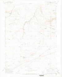
North Rattlesnake Butte, Colorado, USGS topographic map dated 1971.
Includes geographic coordinates (latitude and longitude). This topographic map is suitable for hiking, camping, and exploring, or framing it as a wall map.
Printed on-demand using high resolution imagery, on heavy weight and acid free paper, or alternatively on a variety of synthetic materials.
Topos available on paper, Waterproof, Poly, or Tyvek. Usually shipping rolled, unless combined with other folded maps in one order.
- Product Number: USGS-5353971
- Free digital map download (high-resolution, GeoPDF): North Rattlesnake Butte, Colorado (file size: 5 MB)
- Map Size: please refer to the dimensions of the GeoPDF map above
- Weight (paper map): ca. 55 grams
- Map Type: POD USGS Topographic Map
- Map Series: HTMC
- Map Verison: Historical
- Cell ID: 32456
- Scan ID: 401527
- Imprint Year: 1974
- Aerial Photo Year: 1969
- Field Check Year: 1971
- Datum: NAD27
- Map Projection: Lambert Conformal Conic
- Map published by United States Geological Survey
- Map Language: English
- Scanner Resolution: 508 dpi
- Map Cell Name: North Rattlesnake Butte
- Grid size: 7.5 X 7.5 Minute
- Date on map: 1971
- Map Scale: 1:24000
- Geographical region: Colorado, United States
Neighboring Maps:
All neighboring USGS topo maps are available for sale online at a variety of scales.
Spatial coverage:
Topo map North Rattlesnake Butte, Colorado, covers the geographical area associated the following places:
- Gold Mine Reservoir - Machatten Reservoir - Deus Lake - North Lone Jack Reservoir - Woodey Spring - Price Reservoir - Bobins Pocket Spring - Butte Reservoir - Bogue Reservoir - Center Well - West Well - The Beardsley - Dime Spring - Ronfeldt Reservoir - Lone Jack Reservoir - Baxter Reservoir - Oxbow Well - Church Lakes - Overshaun Reservoir - South Canyon Lake - Reynolds Reservoir - Teeple Reservoir - Tickle Tank - Upper Woodey Spring - Hans Reservoir - Teeple Well - United States Government Reservoir - Lambert Reservoir - Peterson Reservoir - Becker Well - Machatten Well - Tinaja Canyon - Pierce Reservoir - Pacheco Spring - East Turkey Canyon - North Rattlesnake Butte - Six Thousand Reservoir - Hogback - Overton Reservoir - Doyle Arroyo Reservoir - Duran Spring - Chase Ranch - Southeast Reservoir
- Map Area ID: AREA37.87537.75-104.5-104.375
- Northwest corner Lat/Long code: USGSNW37.875-104.5
- Northeast corner Lat/Long code: USGSNE37.875-104.375
- Southwest corner Lat/Long code: USGSSW37.75-104.5
- Southeast corner Lat/Long code: USGSSE37.75-104.375
- Northern map edge Latitude: 37.875
- Southern map edge Latitude: 37.75
- Western map edge Longitude: -104.5
- Eastern map edge Longitude: -104.375


