
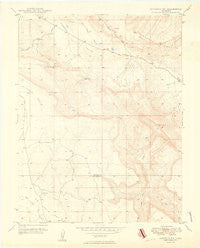
~ Naturita NW CO topo map, 1:24000 scale, 7.5 X 7.5 Minute, Historical, 1949
Naturita NW, Colorado, USGS topographic map dated 1949.
Includes geographic coordinates (latitude and longitude). This topographic map is suitable for hiking, camping, and exploring, or framing it as a wall map.
Printed on-demand using high resolution imagery, on heavy weight and acid free paper, or alternatively on a variety of synthetic materials.
Topos available on paper, Waterproof, Poly, or Tyvek. Usually shipping rolled, unless combined with other folded maps in one order.
- Product Number: USGS-5353795
- Free digital map download (high-resolution, GeoPDF): Naturita NW, Colorado (file size: 7 MB)
- Map Size: please refer to the dimensions of the GeoPDF map above
- Weight (paper map): ca. 55 grams
- Map Type: POD USGS Topographic Map
- Map Series: HTMC
- Map Verison: Historical
- Cell ID: 31405
- Scan ID: 401538
- Aerial Photo Year: 1947
- Field Check Year: 1948
- Datum: NAD27
- Map Projection: Polyconic
- Map published by United States Geological Survey
- Map Language: English
- Scanner Resolution: 508 dpi
- Map Cell Name: Naturita NW
- Grid size: 7.5 X 7.5 Minute
- Date on map: 1949
- Map Scale: 1:24000
- Geographical region: Colorado, United States
Neighboring Maps:
All neighboring USGS topo maps are available for sale online at a variety of scales.
Spatial coverage:
Topo map Naturita NW, Colorado, covers the geographical area associated the following places:
- West Fork Dry Creek - Mineral Joe Group Mine - Spectacle Reservoir - Maybe Mine - Dry Creek Canyon - Nil Number Two Mine - J.J. Mine - Thunderbolt Mine - Sawtooth Ridge - Black Eagle Mine - Paradox D Mine - Deer Shaft Mine - Nil-Trace Group Mines - Rigel Mine - Lone Cedar Mine - Paradox Number Four Mine - BTM Claim Group Mine - Corral Number 2 - Mineral Joe Number Two Mine
- Map Area ID: AREA38.2538.125-108.75-108.625
- Northwest corner Lat/Long code: USGSNW38.25-108.75
- Northeast corner Lat/Long code: USGSNE38.25-108.625
- Southwest corner Lat/Long code: USGSSW38.125-108.75
- Southeast corner Lat/Long code: USGSSE38.125-108.625
- Northern map edge Latitude: 38.25
- Southern map edge Latitude: 38.125
- Western map edge Longitude: -108.75
- Eastern map edge Longitude: -108.625


