
~ Johnson Canyon CO topo map, 1:24000 scale, 7.5 X 7.5 Minute, Historical, 1972, updated 1985
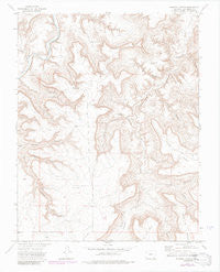
Johnson Canyon, Colorado, USGS topographic map dated 1972.
Includes geographic coordinates (latitude and longitude). This topographic map is suitable for hiking, camping, and exploring, or framing it as a wall map.
Printed on-demand using high resolution imagery, on heavy weight and acid free paper, or alternatively on a variety of synthetic materials.
Topos available on paper, Waterproof, Poly, or Tyvek. Usually shipping rolled, unless combined with other folded maps in one order.
- Product Number: USGS-5351677
- Free digital map download (high-resolution, GeoPDF): Johnson Canyon, Colorado (file size: 9 MB)
- Map Size: please refer to the dimensions of the GeoPDF map above
- Weight (paper map): ca. 55 grams
- Map Type: POD USGS Topographic Map
- Map Series: HTMC
- Map Verison: Historical
- Cell ID: 22685
- Scan ID: 401309
- Imprint Year: 1985
- Photo Revision Year: 1984
- Aerial Photo Year: 1983
- Edit Year: 1984
- Datum: NAD27
- Map Projection: Lambert Conformal Conic
- Map published by United States Geological Survey
- Map Language: English
- Scanner Resolution: 508 dpi
- Map Cell Name: Johnson Canyon
- Grid size: 7.5 X 7.5 Minute
- Date on map: 1972
- Map Scale: 1:24000
- Geographical region: Colorado, United States
Neighboring Maps:
All neighboring USGS topo maps are available for sale online at a variety of scales.
Spatial coverage:
Topo map Johnson Canyon, Colorado, covers the geographical area associated the following places:
- Lost Canyon - Johnson Cemetery - Whitewater Canyon - Sandoval Canyon - Calf Canyon - Goat Ranch Canyon - Lower Windmill - Double Tank Windmill - Chacuaco Canyon - Water Canyon - Jecan Airport - Umbrella Canyon - Upper Windmill - Scorpio Canyon - Round Corral Windmill - Lions Canyon - Lockwood Arroyo - Barriet Canyon - Garfield Windmill - Trough Canyon - Jones Canyon - Lockwood Canyon - Plum Creek - Barriet Spring - Johnson Canyon
- Map Area ID: AREA37.537.375-103.75-103.625
- Northwest corner Lat/Long code: USGSNW37.5-103.75
- Northeast corner Lat/Long code: USGSNE37.5-103.625
- Southwest corner Lat/Long code: USGSSW37.375-103.75
- Southeast corner Lat/Long code: USGSSE37.375-103.625
- Northern map edge Latitude: 37.5
- Southern map edge Latitude: 37.375
- Western map edge Longitude: -103.75
- Eastern map edge Longitude: -103.625


