
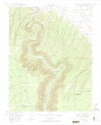
~ Joe Davis Hill CO topo map, 1:24000 scale, 7.5 X 7.5 Minute, Historical, 1949, updated 1974
Joe Davis Hill, Colorado, USGS topographic map dated 1949.
Includes geographic coordinates (latitude and longitude). This topographic map is suitable for hiking, camping, and exploring, or framing it as a wall map.
Printed on-demand using high resolution imagery, on heavy weight and acid free paper, or alternatively on a variety of synthetic materials.
Topos available on paper, Waterproof, Poly, or Tyvek. Usually shipping rolled, unless combined with other folded maps in one order.
- Product Number: USGS-5351645
- Free digital map download (high-resolution, GeoPDF): Joe Davis Hill, Colorado (file size: 9 MB)
- Map Size: please refer to the dimensions of the GeoPDF map above
- Weight (paper map): ca. 55 grams
- Map Type: POD USGS Topographic Map
- Map Series: HTMC
- Map Verison: Historical
- Cell ID: 22641
- Scan ID: 401299
- Imprint Year: 1974
- Woodland Tint: Yes
- Visual Version Number: 1
- Aerial Photo Year: 1947
- Field Check Year: 1949
- Datum: NAD27
- Map Projection: Polyconic
- Map published by United States Geological Survey
- Map Language: English
- Scanner Resolution: 508 dpi
- Map Cell Name: Joe Davis Hill
- Grid size: 7.5 X 7.5 Minute
- Date on map: 1949
- Map Scale: 1:24000
- Geographical region: Colorado, United States
Neighboring Maps:
All neighboring USGS topo maps are available for sale online at a variety of scales.
Spatial coverage:
Topo map Joe Davis Hill, Colorado, covers the geographical area associated the following places:
- Red Top Mine - Dolores River Mine - Wayne Rogers Reservoir Number One - Quakie Spring - Bell Canyon Reservoir - Fox Mine - Sara M. Mine - Muleshoe Six Mine - Wally Mine - Bell Canyon - Spud Patch Mine - Rim Mine - North Reservoir - Sand Rock Reservoir - South Branch Chico Creek - Mystery Mine - Suncup Two Mine - Marne Mine - Red Rock Four and Five Mines - Norma Jean Number 2 Mine - Buckhorn Mine - Philura Group Mine - Norma Jean Mine - Depression Mine - Horseshoe One through Seven Mines - Wilson Reservoir - Little Roy Mine - Rogers-Dalton Reservoir - Parrot Mine - Egnar Heliport - Mucho Grande Mine - DR Reservoir - Roy Lee Mine - Joe Davis Hill - Park Reservoir - France Mine - Suncup Mine - Wayne Rogers Reservoir Number Two - Space Ship Number One Mine - Little Max Mine - Full Moon Group Mine - Spud Patch Camp - Pony Reservoir - Pole Canyon Reservoir - Joe Davis Hill Mine - Sarah Ellen Mine - Full Moon Mine - Parrot Group Mine - Piney Spring - Betty Ruth Mine - Owensby Mine - Little Pony Reservoir - Red Rock Mine - Powder Drift Mine - Uncle Sam Mine - Mardi Mine - S.B. Group Mine - Dan Mine - Clear View Claims - Sawmill Spring - Uncle Sammy Mine - Curtis Mine
- Map Area ID: AREA3837.875-108.875-108.75
- Northwest corner Lat/Long code: USGSNW38-108.875
- Northeast corner Lat/Long code: USGSNE38-108.75
- Southwest corner Lat/Long code: USGSSW37.875-108.875
- Southeast corner Lat/Long code: USGSSE37.875-108.75
- Northern map edge Latitude: 38
- Southern map edge Latitude: 37.875
- Western map edge Longitude: -108.875
- Eastern map edge Longitude: -108.75


