
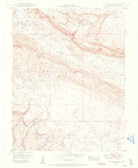
~ Hamm Canyon CO topo map, 1:24000 scale, 7.5 X 7.5 Minute, Historical, 1948, updated 1955
Hamm Canyon, Colorado, USGS topographic map dated 1948.
Includes geographic coordinates (latitude and longitude). This topographic map is suitable for hiking, camping, and exploring, or framing it as a wall map.
Printed on-demand using high resolution imagery, on heavy weight and acid free paper, or alternatively on a variety of synthetic materials.
Topos available on paper, Waterproof, Poly, or Tyvek. Usually shipping rolled, unless combined with other folded maps in one order.
- Product Number: USGS-5350739
- Free digital map download (high-resolution, GeoPDF): Hamm Canyon, Colorado (file size: 7 MB)
- Map Size: please refer to the dimensions of the GeoPDF map above
- Weight (paper map): ca. 55 grams
- Map Type: POD USGS Topographic Map
- Map Series: HTMC
- Map Verison: Historical
- Cell ID: 19107
- Scan ID: 450997
- Imprint Year: 1955
- Aerial Photo Year: 1947
- Field Check Year: 1948
- Datum: NAD27
- Map Projection: Polyconic
- Map published by United States Geological Survey
- Map Language: English
- Scanner Resolution: 508 dpi
- Map Cell Name: Hamm Canyon
- Grid size: 7.5 X 7.5 Minute
- Date on map: 1948
- Map Scale: 1:24000
- Geographical region: Colorado, United States
Neighboring Maps:
All neighboring USGS topo maps are available for sale online at a variety of scales.
Spatial coverage:
Topo map Hamm Canyon, Colorado, covers the geographical area associated the following places:
- Nicholas Wash - Wimpy Mine - Disappointment Creek - Vanura Claims Mine - S and D Mine - Sunday Mine - Duncan Mine - Blue Creek Mine - Murietta Mine - Pooch Mine - Big Gypsum Creek - Sunday Number 2 Mine - Old Mexico Mine - Payday Mine - Chile Number 5 Mine - Maggie Number Two Mine - Uncle Sam Mine - New Mexico Mine - Ely Mine - Donald Hill Mine - Jim Two Mine - Eclipse Mine - Lookout Mine - Red Horse Mine - Gypsum Homestead Mine - Carnation Number Four Mine - Carnation Number Two Mine - Morning Glory Mine - Uncle Sam Mine - Jack-o-lantern Mine - Sunshine Six Mine - Joe Davis Canyon - Chesta Mine - Saint Jude Mine - Carnation Number Three Mine - Topaz Claims Mine - Carnation Mine - Glen Mine - West Sunday Mine - New Uncle Sam Mine - Mary Jane Draw - West San Miguel Division - Robert M Mine - Doss Claim Group Mine - G M G Mine - Breezy Mine - Lookout Mine - Bluff Mine - Rambler Rose Mine - Broadway Mine - Inspiration Fifteen Mine - Inspiration One Mine - Dugout Wash - Rainy Day Mine - Disappointment Valley - Hamm Canyon - Big Gypsum Valley - Blue Canyon - Bobcat Mine - Sunday Mine - Jackpot Group Mine - Breezy Mine - Riverview Mine - Dolores Canyon - Magpie Mine - Sego Lily Lou Mine - Morrison Canyon - Mesa Seven Mine - Mexico Mines - Magpie Number 2 Mine - Topaz Mine - Sunset Mine
- Map Area ID: AREA38.12538-108.875-108.75
- Northwest corner Lat/Long code: USGSNW38.125-108.875
- Northeast corner Lat/Long code: USGSNE38.125-108.75
- Southwest corner Lat/Long code: USGSSW38-108.875
- Southeast corner Lat/Long code: USGSSE38-108.75
- Northern map edge Latitude: 38.125
- Southern map edge Latitude: 38
- Western map edge Longitude: -108.875
- Eastern map edge Longitude: -108.75


