
~ Corral Bluffs CO topo map, 1:24000 scale, 7.5 X 7.5 Minute, Historical, 1949
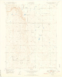
Corral Bluffs, Colorado, USGS topographic map dated 1949.
Includes geographic coordinates (latitude and longitude). This topographic map is suitable for hiking, camping, and exploring, or framing it as a wall map.
Printed on-demand using high resolution imagery, on heavy weight and acid free paper, or alternatively on a variety of synthetic materials.
Topos available on paper, Waterproof, Poly, or Tyvek. Usually shipping rolled, unless combined with other folded maps in one order.
- Product Number: USGS-5348391
- Free digital map download (high-resolution, GeoPDF): Corral Bluffs, Colorado (file size: 6 MB)
- Map Size: please refer to the dimensions of the GeoPDF map above
- Weight (paper map): ca. 55 grams
- Map Type: POD USGS Topographic Map
- Map Series: HTMC
- Map Verison: Historical
- Cell ID: 10184
- Scan ID: 400807
- Aerial Photo Year: 1947
- Field Check Year: 1948
- Datum: NAD27
- Map Projection: Polyconic
- Map published by United States Army Corps of Engineers
- Map Language: English
- Scanner Resolution: 508 dpi
- Map Cell Name: Corral Bluffs
- Grid size: 7.5 X 7.5 Minute
- Date on map: 1949
- Map Scale: 1:24000
- Geographical region: Colorado, United States
Neighboring Maps:
All neighboring USGS topo maps are available for sale online at a variety of scales.
Spatial coverage:
Topo map Corral Bluffs, Colorado, covers the geographical area associated the following places:
- Hammer Ranch - Guitman Ranch - Corley Coal Mine Number Three - Balser Ranch - Gieck Ranch - Titus Ranch - Polo Ranch - Boucher Ranch - Bishop Ranch - Novak Ranch - Ellicott Fire Department Station 4 - Corral Bluffs - Flying Lazy S Ranch - Schriever Air Force Base - Colorado Springs Landfill - Franceville Mine - Slocum Ranch - Dentan Ranch - Benedict Ranch - Clara Belle Mine - Schriever Air Force Base Fire Department - Bledsoe Ranch (historical) - Dixie Mine - Mitchell Ranch - El Paso County - Davis Ranch
- Map Area ID: AREA38.87538.75-104.625-104.5
- Northwest corner Lat/Long code: USGSNW38.875-104.625
- Northeast corner Lat/Long code: USGSNE38.875-104.5
- Southwest corner Lat/Long code: USGSSW38.75-104.625
- Southeast corner Lat/Long code: USGSSE38.75-104.5
- Northern map edge Latitude: 38.875
- Southern map edge Latitude: 38.75
- Western map edge Longitude: -104.625
- Eastern map edge Longitude: -104.5


