
~ Bull Canyon CO topo map, 1:24000 scale, 7.5 X 7.5 Minute, Historical, 1948, updated 1955
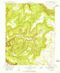
Bull Canyon, Colorado, USGS topographic map dated 1948.
Includes geographic coordinates (latitude and longitude). This topographic map is suitable for hiking, camping, and exploring, or framing it as a wall map.
Printed on-demand using high resolution imagery, on heavy weight and acid free paper, or alternatively on a variety of synthetic materials.
Topos available on paper, Waterproof, Poly, or Tyvek. Usually shipping rolled, unless combined with other folded maps in one order.
- Product Number: USGS-5347389
- Free digital map download (high-resolution, GeoPDF): Bull Canyon, Colorado (file size: 13 MB)
- Map Size: please refer to the dimensions of the GeoPDF map above
- Weight (paper map): ca. 55 grams
- Map Type: POD USGS Topographic Map
- Map Series: HTMC
- Map Verison: Historical
- Cell ID: 6113
- Scan ID: 232401
- Imprint Year: 1955
- Woodland Tint: Yes
- Aerial Photo Year: 1947
- Field Check Year: 1948
- Datum: NAD27
- Map Projection: Polyconic
- Map published by United States Geological Survey
- Map Language: English
- Scanner Resolution: 600 dpi
- Map Cell Name: Bull Canyon
- Grid size: 7.5 X 7.5 Minute
- Date on map: 1948
- Map Scale: 1:24000
- Geographical region: Colorado, United States
Neighboring Maps:
All neighboring USGS topo maps are available for sale online at a variety of scales.
Spatial coverage:
Topo map Bull Canyon, Colorado, covers the geographical area associated the following places:
- Wedding Bell Mine - Horsehair Mine - Yellow Bird Mine - Slick Rim Mine - Captain Jack Group Mine - Pickett Corral Number Two Mine - Mary Ann Mine - High Ball Mine - Camoose Mine - Goodenough Number One Mine - Fawn Springs Number Eighteen Mine - Camel Number Six Mine - Rim Rock Number 3 Mine - Venture Mine - Red Flash Mine - School Marm Mine - Fawn Springs Number Five Mine - Mary Ann Number Four Mine - Red Flag Incline Mine - Hot Shot Mine - Red Flat Number Six Mine - Echo Number Four Mine - Fawn Springs Bench - Cummings Spring - Rim Rock Number Six Mine - Teapot Dome Number 2 Mine - Wild Horse Draw - Jack Knife Three Mine - Uranus Mine - Starlight Number Two Mine - Iola Mine - Sunrise Mine - Black Diamond Mine - Peggy Mine - Sunrise Number Two Mine - Fawn Springs Number Four Mine - September Morning Mine - Royal Oak Mine - Peters Knob - Sunrise Mine - Peanut Number 3 Mine - San Pedro Mine - Corral Draw - Lucky Boy Mine - Joe Dandy Mine - Nil Number One Mine - Obnoxious Mine - September Morn Number One Mine - Radium Hill Number Twelve Mine - Long Park Incline Mine - Mary Number Four Mine - Blue Moon Mine - Dorothy Jean Number Two Mine - Fawn Springs Number Eleven Mine - Peanut East Central Mine - Radium Hill Group Mine - Fawn Springs Number Fifteen Mine - September Morn Number Two Mine - Rim Rock Number Fourteen Mine - Starlight Mine - Rim Rock Blues Number Twelve Mine - Monogram Mines - Fawn Springs Number Two Mine - Wild Steer Mines - Indian Henrys Cabin - Bachelor Draw - Sunrise Number Four Mine - Fawn Springs Number Twenty-nine Mine - Rim Rock Number Two Mine - High Ball Five Mine - Rim Rock Blues Number Six East Mine - Goodenough Number Two Mine - Bobtail Mine - Rim Rock Blues Number Sixteen Mine - Skein Mesa Reservoir - Fawn Springs Number 5 Mine - Broker Mine - Zebra Mine - Vernita Mine - West End Mine - Goodenough Number Three Mine - Chipmunk Mine - Rim Rock Mine - Venture Lodge Mine - Solitaire and Jack Pot Claims Group Mine - Navajo Mine - Lucky Day Mine - Burro Point Mine - Starlight Number Four Mine - Jack Knife Mine - Ura Mine - Rim Rock Blues Number Three Mine - Peanut Number Four Mine - Peanut Incline Number Five Mine - Bob Number Eight Mine - Log Cabin Mine - Rim Rock Blues Number Four Mine - Quarrel Group Mine - Wedding Bell Camp - Calf Spring
- Map Area ID: AREA38.2538.125-108.875-108.75
- Northwest corner Lat/Long code: USGSNW38.25-108.875
- Northeast corner Lat/Long code: USGSNE38.25-108.75
- Southwest corner Lat/Long code: USGSSW38.125-108.875
- Southeast corner Lat/Long code: USGSSE38.125-108.75
- Northern map edge Latitude: 38.25
- Southern map edge Latitude: 38.125
- Western map edge Longitude: -108.875
- Eastern map edge Longitude: -108.75


