
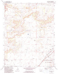
~ Bates Lake CO topo map, 1:24000 scale, 7.5 X 7.5 Minute, Historical, 1993, updated 1993
Bates Lake, Colorado, USGS topographic map dated 1993.
Includes geographic coordinates (latitude and longitude). This topographic map is suitable for hiking, camping, and exploring, or framing it as a wall map.
Printed on-demand using high resolution imagery, on heavy weight and acid free paper, or alternatively on a variety of synthetic materials.
Topos available on paper, Waterproof, Poly, or Tyvek. Usually shipping rolled, unless combined with other folded maps in one order.
- Product Number: USGS-5346641
- Free digital map download (high-resolution, GeoPDF): Bates Lake, Colorado (file size: 9 MB)
- Map Size: please refer to the dimensions of the GeoPDF map above
- Weight (paper map): ca. 55 grams
- Map Type: POD USGS Topographic Map
- Map Series: HTMC
- Map Verison: Historical
- Cell ID: 2616
- Scan ID: 232212
- Imprint Year: 1993
- Woodland Tint: Yes
- Aerial Photo Year: 1988
- Edit Year: 1993
- Field Check Year: 1991
- Datum: NAD27
- Map Projection: Universal Transverse Mercator
- Map published by United States Geological Survey
- Map Language: English
- Scanner Resolution: 600 dpi
- Map Cell Name: Bates Lake
- Grid size: 7.5 X 7.5 Minute
- Date on map: 1993
- Map Scale: 1:24000
- Geographical region: Colorado, United States
Neighboring Maps:
All neighboring USGS topo maps are available for sale online at a variety of scales.
Spatial coverage:
Topo map Bates Lake, Colorado, covers the geographical area associated the following places:
- Rowe Reservoir - Bates Lake - West Cross Canyon - Bates Reservoir - Tyler Hill - Port Arroyo Windmill - Twin Lakes - Ahern Windmill - Baker Reservoir - Eperson Windmill - Rowe Spring - East Cross Canyon - Sutton Windmill - West Pasture Windmill - Pool Windmill - Smith Ranch Windmill - Tyrone Flats
- Map Area ID: AREA37.62537.5-104.25-104.125
- Northwest corner Lat/Long code: USGSNW37.625-104.25
- Northeast corner Lat/Long code: USGSNE37.625-104.125
- Southwest corner Lat/Long code: USGSSW37.5-104.25
- Southeast corner Lat/Long code: USGSSE37.5-104.125
- Northern map edge Latitude: 37.625
- Southern map edge Latitude: 37.5
- Western map edge Longitude: -104.25
- Eastern map edge Longitude: -104.125


