
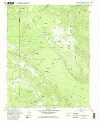
~ Baldy Mountain CO topo map, 1:24000 scale, 7.5 X 7.5 Minute, Historical, 1964, updated 1980
Baldy Mountain, Colorado, USGS topographic map dated 1964.
Includes geographic coordinates (latitude and longitude). This topographic map is suitable for hiking, camping, and exploring, or framing it as a wall map.
Printed on-demand using high resolution imagery, on heavy weight and acid free paper, or alternatively on a variety of synthetic materials.
Topos available on paper, Waterproof, Poly, or Tyvek. Usually shipping rolled, unless combined with other folded maps in one order.
- Product Number: USGS-5346563
- Free digital map download (high-resolution, GeoPDF): Baldy Mountain, Colorado (file size: 12 MB)
- Map Size: please refer to the dimensions of the GeoPDF map above
- Weight (paper map): ca. 55 grams
- Map Type: POD USGS Topographic Map
- Map Series: HTMC
- Map Verison: Historical
- Cell ID: 2251
- Scan ID: 232198
- Imprint Year: 1980
- Woodland Tint: Yes
- Visual Version Number: 1
- Aerial Photo Year: 1960
- Field Check Year: 1964
- Datum: NAD27
- Map Projection: Polyconic
- Map published by United States Geological Survey
- Map published by United States Forest Service
- Map Language: English
- Scanner Resolution: 600 dpi
- Map Cell Name: Baldy Mountain
- Grid size: 7.5 X 7.5 Minute
- Date on map: 1964
- Map Scale: 1:24000
- Geographical region: Colorado, United States
Neighboring Maps:
All neighboring USGS topo maps are available for sale online at a variety of scales.
Spatial coverage:
Topo map Baldy Mountain, Colorado, covers the geographical area associated the following places:
- Bearwallow Creek - Moonlick Spring Number 1 - Shamrock Mine - Mud Spring - Heflin Spring Number 2 - Jungle Canyon - Columbine Mine - Trout Creek - Moonlick Spring Number 2 - Grass Creek - Rock Spring - Yellowjacket Pass - Cabin Spring - Heflin Creek - Frying Pan Spring - Bearwallow Spring - Ute Park - Hayden Creek - Muddy Lakes Spring - Beaver Meadow Spring - Heflin Spring Number 1 - Triple S Mine - Uncle Charlie Spring - Little Beaver Creek - Arbogas Flats - Grassy Mountain - Snyder Spring - Sheep Mountain - Spruce Spring - Beaver Meadows - Jungle Spring - Lange Canyon - Hayden Reservoir Number 1 - Rocky Canyon - Pine-Piedra Stock Driveway - Turkey Spring - T N Y Spring - Devils Hole - Medicine Mine - Cooper Mine - Shamrock Mines - Skunk Creek - Arthur Spring - Old Cabin Spring - Iron Spring - Pine-Piedra Stock Driveway - Crib Spring - Indian Mountain - Baldy Mountain - Mountain Lion Spring - Sheep Creek Spring - Mexican Spring - Shamrock Ranch - Dry Lake Reservoir - Medicine Creek - Hidden Spring - Klondike Park - High Point Spring
- Map Area ID: AREA37.37537.25-107.5-107.375
- Northwest corner Lat/Long code: USGSNW37.375-107.5
- Northeast corner Lat/Long code: USGSNE37.375-107.375
- Southwest corner Lat/Long code: USGSSW37.25-107.5
- Southeast corner Lat/Long code: USGSSE37.25-107.375
- Northern map edge Latitude: 37.375
- Southern map edge Latitude: 37.25
- Western map edge Longitude: -107.5
- Eastern map edge Longitude: -107.375


