
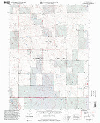
~ Baker Draw CO topo map, 1:24000 scale, 7.5 X 7.5 Minute, Historical, 1997, updated 2000
Baker Draw, Colorado, USGS topographic map dated 1997.
Includes geographic coordinates (latitude and longitude). This topographic map is suitable for hiking, camping, and exploring, or framing it as a wall map.
Printed on-demand using high resolution imagery, on heavy weight and acid free paper, or alternatively on a variety of synthetic materials.
Topos available on paper, Waterproof, Poly, or Tyvek. Usually shipping rolled, unless combined with other folded maps in one order.
- Product Number: USGS-5346541
- Free digital map download (high-resolution, GeoPDF): Baker Draw, Colorado (file size: 15 MB)
- Map Size: please refer to the dimensions of the GeoPDF map above
- Weight (paper map): ca. 55 grams
- Map Type: POD USGS Topographic Map
- Map Series: HTMC
- Map Verison: Historical
- Cell ID: 2171
- Scan ID: 232188
- Imprint Year: 2000
- Aerial Photo Year: 1993
- Datum: NAD27
- Map Projection: Lambert Conformal Conic
- Map published by United States Geological Survey
- Map published by United States Forest Service
- Map Language: English
- Scanner Resolution: 600 dpi
- Map Cell Name: Baker Draw
- Grid size: 7.5 X 7.5 Minute
- Date on map: 1997
- Map Scale: 1:24000
- Geographical region: Colorado, United States
Neighboring Maps:
All neighboring USGS topo maps are available for sale online at a variety of scales.
Spatial coverage:
Topo map Baker Draw, Colorado, covers the geographical area associated the following places:
- McCartney Windmill - Kaw Windmill - Ridge Windmill - Key Water Well - Antelope Windmill - Rand Windmill - Mitchell Windmill - Range Rider Water Well - Hat Windmill - Mustang Windmill - Sand Reservoir Number 2 - Sorrell Water Well - Elliot Windmill - Stone Corral Windmill - Noble Windmill - Howard Reservoir - Big Bend Windmill - Sand Reservoir Number 1 - Crame Windmill - Missile Windmill - Pawnee National Grassland - Missile West Water Well - Cayuse Windmill - Ball Windmill - Wildhorse Windmill - Phillips Windmill - Baker Draw - Range Rider Headquarters - Sand Creek Windmill - Howard Windmill - Murphy Windmill
- Map Area ID: AREA40.7540.625-104.5-104.375
- Northwest corner Lat/Long code: USGSNW40.75-104.5
- Northeast corner Lat/Long code: USGSNE40.75-104.375
- Southwest corner Lat/Long code: USGSSW40.625-104.5
- Southeast corner Lat/Long code: USGSSE40.625-104.375
- Northern map edge Latitude: 40.75
- Southern map edge Latitude: 40.625
- Western map edge Longitude: -104.5
- Eastern map edge Longitude: -104.375


