
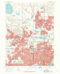
~ Arvada CO topo map, 1:24000 scale, 7.5 X 7.5 Minute, Historical, 1965, updated 1969
Arvada, Colorado, USGS topographic map dated 1965.
Includes geographic coordinates (latitude and longitude). This topographic map is suitable for hiking, camping, and exploring, or framing it as a wall map.
Printed on-demand using high resolution imagery, on heavy weight and acid free paper, or alternatively on a variety of synthetic materials.
Topos available on paper, Waterproof, Poly, or Tyvek. Usually shipping rolled, unless combined with other folded maps in one order.
- Product Number: USGS-5346445
- Free digital map download (high-resolution, GeoPDF): Arvada, Colorado (file size: 16 MB)
- Map Size: please refer to the dimensions of the GeoPDF map above
- Weight (paper map): ca. 55 grams
- Map Type: POD USGS Topographic Map
- Map Series: HTMC
- Map Verison: Historical
- Cell ID: 1593
- Scan ID: 232158
- Imprint Year: 1969
- Woodland Tint: Yes
- Aerial Photo Year: 1964
- Field Check Year: 1965
- Datum: NAD27
- Map Projection: Polyconic
- Map published by United States Geological Survey
- Map Language: English
- Scanner Resolution: 600 dpi
- Map Cell Name: Arvada
- Grid size: 7.5 X 7.5 Minute
- Date on map: 1965
- Map Scale: 1:24000
- Geographical region: Colorado, United States
Neighboring Maps:
All neighboring USGS topo maps are available for sale online at a variety of scales.
Spatial coverage:
Topo map Arvada, Colorado, covers the geographical area associated the following places:
- Lakeview - The Pond - Pioneer Mobile Gardens - Twin Lakes - North Green Valley - Churchhill Downs - Lakeview Meadows - Huntington Heights - Lakeview Estates - Parkway Estates - Westhaven - Wood Creek - Holiday Hills Village - Sierra Estates - Mountain View - Alta Vista - Lakeside - Melrose - Lake Arbor - Olinger Gardens - Scenic Heights - Green Valley - Sunset Ridge - Berkeley Gardens - Sunland - Harris Park - Paradise Acres - Club Crest - Hackberry Hills - Shaw Heights - Hillcrest Heights - Columbine Acres - Oak Park - Skyline Vista - Maplewood Acres - Koldeway - Paramount Heights - Sunstream - Wildwood - Zuni - Park Slope - Berkley - Hidden Creek Park - Westminster Hills - Wood Run - Highland Park - Arvada - Bridle Dale - Rolling Hills - Tennyson Park - Lakecrest - Skyline Estates - Wheat Ridge - Sherrelwood - Lamar Heights - Oberon Acres - Kimberly Hills - Happy Valley Gardens - Lamplighter - Far Horizon - Edgewater - Semper - Homestead Heights - Lakeside - Highland Gardens - The Highlands - Wellington Downs - Cambridge Park - Fairview - Sherrelwood Estates - Lyndale Park - Westminster - Lamar Heights - Sierra Vista - Hidden Lake
- Map Area ID: AREA39.87539.75-105.125-105
- Northwest corner Lat/Long code: USGSNW39.875-105.125
- Northeast corner Lat/Long code: USGSNE39.875-105
- Southwest corner Lat/Long code: USGSSW39.75-105.125
- Southeast corner Lat/Long code: USGSSE39.75-105
- Northern map edge Latitude: 39.875
- Southern map edge Latitude: 39.75
- Western map edge Longitude: -105.125
- Eastern map edge Longitude: -105


