
~ Alpine Plateau CO topo map, 1:24000 scale, 7.5 X 7.5 Minute, Historical, 1963, updated 1966
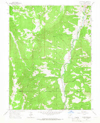
Alpine Plateau, Colorado, USGS topographic map dated 1963.
Includes geographic coordinates (latitude and longitude). This topographic map is suitable for hiking, camping, and exploring, or framing it as a wall map.
Printed on-demand using high resolution imagery, on heavy weight and acid free paper, or alternatively on a variety of synthetic materials.
Topos available on paper, Waterproof, Poly, or Tyvek. Usually shipping rolled, unless combined with other folded maps in one order.
- Product Number: USGS-5346233
- Free digital map download (high-resolution, GeoPDF): Alpine Plateau, Colorado (file size: 12 MB)
- Map Size: please refer to the dimensions of the GeoPDF map above
- Weight (paper map): ca. 55 grams
- Map Type: POD USGS Topographic Map
- Map Series: HTMC
- Map Verison: Historical
- Cell ID: 705
- Scan ID: 232085
- Imprint Year: 1966
- Woodland Tint: Yes
- Aerial Photo Year: 1962
- Field Check Year: 1963
- Datum: NAD27
- Map Projection: Polyconic
- Map published by United States Geological Survey
- Map Language: English
- Scanner Resolution: 600 dpi
- Map Cell Name: Alpine Plateau
- Grid size: 7.5 X 7.5 Minute
- Date on map: 1963
- Map Scale: 1:24000
- Geographical region: Colorado, United States
Neighboring Maps:
All neighboring USGS topo maps are available for sale online at a variety of scales.
Spatial coverage:
Topo map Alpine Plateau, Colorado, covers the geographical area associated the following places:
- Hells Canyon - Thompson Ditch Number 2 - Elk Creek - Campbell Creek - Devils Creek - Trout Creek - Spring Gulch - Thompson Ditch - Copeland Elk Creek Ditch - Ridge Stock Driveway - High Bridge Gulch - Nurse - Brownlee Cemetery - Thomas Ranch - Narrow Grade Creek - Whinnery Ranch - Youman Ditch - Fourth of July Creek - Alpine Plateau - Alpine Corral - Thompson Ranch - Baldy - Little Elk Creek - Ute Trail Ranch - Dwyer Gulch - The Gate - Ferrara Ranch Mine - Well Gulch - Wilson Ranch - Big Buck Creek - Big Willow Park - Skunk Creek
- Map Area ID: AREA38.2538.125-107.375-107.25
- Northwest corner Lat/Long code: USGSNW38.25-107.375
- Northeast corner Lat/Long code: USGSNE38.25-107.25
- Southwest corner Lat/Long code: USGSSW38.125-107.375
- Southeast corner Lat/Long code: USGSSE38.125-107.25
- Northern map edge Latitude: 38.25
- Southern map edge Latitude: 38.125
- Western map edge Longitude: -107.375
- Eastern map edge Longitude: -107.25


