
~ Irish Mountain OR topo map, 1:24000 scale, 7.5 X 7.5 Minute, Historical, 2011
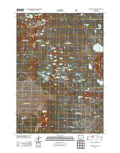
Irish Mountain, Oregon, USGS topographic map dated 2011.
Includes geographic coordinates (latitude and longitude). This topographic map is suitable for hiking, camping, and exploring, or framing it as a wall map.
Printed on-demand using high resolution imagery, on heavy weight and acid free paper, or alternatively on a variety of synthetic materials.
Topos available on paper, Waterproof, Poly, or Tyvek. Usually shipping rolled, unless combined with other folded maps in one order.
- Product Number: USGS-5345972
- Free digital map download (high-resolution, GeoPDF): Irish Mountain, Oregon (file size: 29 MB)
- Map Size: please refer to the dimensions of the GeoPDF map above
- Weight (paper map): ca. 55 grams
- Map Type: POD USGS Topographic Map
- Map Series: US Topo
- Map Verison: Historical
- Cell ID: 22042
- Datum: North American Datum of 1983
- Map Projection: Transverse Mercator
- Map Cell Name: Irish Mountain
- Grid size: 7.5 X 7.5 Minute
- Date on map: 2011
- Map Scale: 1:24000
- Geographical region: Oregon, United States
Neighboring Maps:
All neighboring USGS topo maps are available for sale online at a variety of scales.
Spatial coverage:
Topo map Irish Mountain, Oregon, covers the geographical area associated the following places:
- East McFarland Lake - Merle Lake - Lodgepole Lake - Phantom Lake - Deer Lake - Clark Lake - Clover Meadow - Charlton Butte - Heather Lake - Dennis Lake - Harralson Horse Camp - Piper Lake - West Cultus Lake Recreation Site - Cathy Lake - Lindick Lake - McFarland Lake - Stormy Lake - Benz Spring - Raft Lake - Blaze Lake - Taylor Lake - Teddy Lakes - Riffle Lake - Barbie Lakes - Jezebel Lake - Irish and Taylor Recreation Site - Kershaw Lake - Lily Lake - Tranquil Lake - Lady Lake - Simon Lake - Copper Lake - Crossing Way - Irish Lake - Lemish Lake - Muskrat Lake - East Hanks Lake - Strider Lake - Middle Hanks Lake - Pygmy Lake - Blowdown Lake - Gleneden Lake - Red Slide Lake - Timmy Lake - Rock Rim Lake - Josephine Lake - Kinnikinnic Lake - Lois Lake - Pillar Peak - Lemish Butte - Harlequin Lake - West Hanks Lake - Pocket Lake - Smith Lake - Irish Mountain - Winopee Lake Trail - Sundew Lake - Navaho Lake - Brahma Lake - Jay Lake - Swede Lake
- Map Area ID: AREA43.87543.75-122-121.875
- Northwest corner Lat/Long code: USGSNW43.875-122
- Northeast corner Lat/Long code: USGSNE43.875-121.875
- Southwest corner Lat/Long code: USGSSW43.75-122
- Southeast corner Lat/Long code: USGSSE43.75-121.875
- Northern map edge Latitude: 43.875
- Southern map edge Latitude: 43.75
- Western map edge Longitude: -122
- Eastern map edge Longitude: -121.875


