
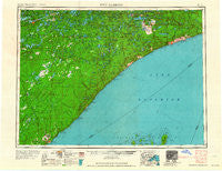
~ Two Harbors MN topo map, 1:250000 scale, 1 X 2 Degree, Historical, 1964
Two Harbors, Minnesota, USGS topographic map dated 1964.
Includes geographic coordinates (latitude and longitude). This topographic map is suitable for hiking, camping, and exploring, or framing it as a wall map.
Printed on-demand using high resolution imagery, on heavy weight and acid free paper, or alternatively on a variety of synthetic materials.
Topos available on paper, Waterproof, Poly, or Tyvek. Usually shipping rolled, unless combined with other folded maps in one order.
- Product Number: USGS-5345776
- Free digital map download (high-resolution, GeoPDF): Two Harbors, Minnesota (file size: 13 MB)
- Map Size: please refer to the dimensions of the GeoPDF map above
- Weight (paper map): ca. 55 grams
- Map Type: POD USGS Topographic Map
- Map Series: HTMC
- Map Verison: Historical
- Cell ID: 72252
- Scan ID: 805402
- Woodland Tint: Yes
- Field Check Year: 1954
- Datum: Unstated
- Map Projection: Transverse Mercator
- Map published by United States Geological Survey
- Map Language: English
- Scanner Resolution: 508 dpi
- Map Cell Name: Two Harbors
- Grid size: 1 X 2 Degree
- Date on map: 1964
- Map Scale: 1:250000
- Geographical region: Minnesota, United States
Neighboring Maps:
All neighboring USGS topo maps are available for sale online at a variety of scales.
Spatial coverage:
Topo map Two Harbors, Minnesota, covers the geographical area associated the following places:
- Lax Lake - Silver Bay - Ely - Winter - Section Thirty - Northern Terrace Mobile Home Park - York - Lutsen Mobile Home Park - Cramer - Little Marais - Tofte - White Iron - Highland - East Beaver Bay - Norshor Junction - Wales - Clappers - Chippewa City - Murphy City - Two Harbors - Sawbill Landing - Reno - Waldo - Kennedy Landing - McNair - Voyageur Trailer Park - Babbitt - Castle Danger - Greenwood Junction - Lamb's Mobile Home Park - Baptism Crossing - Brimson - Little Marais Postoffice - Darby Junction - Maple Hill - Grand Marais - Rothman - Lauren - Pine Mountain Trailer Court - Happy Wanderer - Bell Harbor - Whyte - Breda - Fairbanks - Martin Landing - Hornby - Taconite Harbor - Isabella - Finland - Stewart - Forest Center - Beaver Bay - Burntside - Toimi - Covill - Croftville - Kelly Landing - Beaver Crossing - Scott Junction - Lutsen - Illgen City - Wheeler Landing - London - Skibo - Alger - Rollins - Maple - Winton - Jordan - Schroeder - Silver Rapids - Silver Creek - Bassett - Jay See Landing - Manitou Junction
- Map Area ID: AREA4847-92-90
- Northwest corner Lat/Long code: USGSNW48-92
- Northeast corner Lat/Long code: USGSNE48-90
- Southwest corner Lat/Long code: USGSSW47-92
- Southeast corner Lat/Long code: USGSSE47-90
- Northern map edge Latitude: 48
- Southern map edge Latitude: 47
- Western map edge Longitude: -92
- Eastern map edge Longitude: -90


