
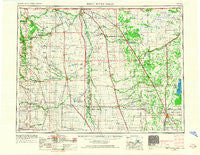
~ Thief River Falls MN topo map, 1:250000 scale, 1 X 2 Degree, Historical, 1952, updated 1967
Thief River Falls, Minnesota, USGS topographic map dated 1952.
Includes geographic coordinates (latitude and longitude). This topographic map is suitable for hiking, camping, and exploring, or framing it as a wall map.
Printed on-demand using high resolution imagery, on heavy weight and acid free paper, or alternatively on a variety of synthetic materials.
Topos available on paper, Waterproof, Poly, or Tyvek. Usually shipping rolled, unless combined with other folded maps in one order.
- Product Number: USGS-5345770
- Free digital map download (high-resolution, GeoPDF): Thief River Falls, Minnesota (file size: 13 MB)
- Map Size: please refer to the dimensions of the GeoPDF map above
- Weight (paper map): ca. 55 grams
- Map Type: POD USGS Topographic Map
- Map Series: HTMC
- Map Verison: Historical
- Cell ID: 75038
- Scan ID: 805387
- Imprint Year: 1967
- Woodland Tint: Yes
- Edit Year: 1967
- Field Check Year: 1952
- Datum: Unstated
- Map Projection: Transverse Mercator
- Map published by United States Geological Survey
- Map Language: English
- Scanner Resolution: 508 dpi
- Map Cell Name: Thief River Falls
- Grid size: 1 X 2 Degree
- Date on map: 1952
- Map Scale: 1:250000
- Geographical region: Minnesota, United States
Neighboring Maps:
All neighboring USGS topo maps are available for sale online at a variety of scales.
Spatial coverage:
Topo map Thief River Falls, Minnesota, covers the geographical area associated the following places:
- Carpenters Corner - Sherack - Leroy - Kennedy - Honeyford - Crystal - Countryside Mobile Home Park - Thief River Falls - Luna - Auburn - Mandt - Orr - Foldahl - Walhalla - Palisade Mobile Home Park - Hanks Corner - Lake Bronson - Conway - Greenbush - Saint Vincent Junction - Northwestern Trailer Court - Green Lea Mobile Home Park - Ops - Neche - Grafton - Hallock - Bathgate - Northcote - Saint Hilaire - Rosewood - Nash - Kerry - Northside Trailer Park - Florian - Oak Point (historical) - Hamilton - Angus - Riverview Mobile Home Park - Johnstown - Alvarado - Fordville - Donaldson - Gardar - Jenson Trailer Park - Veseleyville - Poland - Oakwood - Svold - Middle River - Sundby Mobile Home Court - Hallson - Holt - Enok - Leyden - Oak View Mobile Home Park - Warsaw - Saint Vincent - Herriott - Akra - Voss - Mattson - Viking - Stephen - Newfolden - Ottention (historical) - Englund - Halma - Saint Thomas - Basswood Court - Bowesmont - East Acres Mobile Home Park - Sultan - Inkster - Gilby - Radium - Backoo - McCanna - Huron City (historical) - Oslo - Argyle - Middle River Mobile Home Park - Glasston - Leo - Pleasant Valley - Haug - Fleece - Drayton - Jamar Mobile Home Park - Manvel - Strathcona - Kellogg - Concrete - Edinburg - Cavalier - Mountain - Deerwood - Herrick - Noacres (historical) - Park River - Minto
- Map Area ID: AREA4948-98-96
- Northwest corner Lat/Long code: USGSNW49-98
- Northeast corner Lat/Long code: USGSNE49-96
- Southwest corner Lat/Long code: USGSSW48-98
- Southeast corner Lat/Long code: USGSSE48-96
- Northern map edge Latitude: 49
- Southern map edge Latitude: 48
- Western map edge Longitude: -98
- Eastern map edge Longitude: -96


