
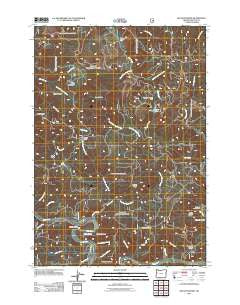
~ Hellion Rapids OR topo map, 1:24000 scale, 7.5 X 7.5 Minute, Historical, 2011
Hellion Rapids, Oregon, USGS topographic map dated 2011.
Includes geographic coordinates (latitude and longitude). This topographic map is suitable for hiking, camping, and exploring, or framing it as a wall map.
Printed on-demand using high resolution imagery, on heavy weight and acid free paper, or alternatively on a variety of synthetic materials.
Topos available on paper, Waterproof, Poly, or Tyvek. Usually shipping rolled, unless combined with other folded maps in one order.
- Product Number: USGS-5332238
- Free digital map download (high-resolution, GeoPDF): Hellion Rapids, Oregon (file size: 26 MB)
- Map Size: please refer to the dimensions of the GeoPDF map above
- Weight (paper map): ca. 55 grams
- Map Type: POD USGS Topographic Map
- Map Series: US Topo
- Map Verison: Historical
- Cell ID: 20041
- Datum: North American Datum of 1983
- Map Projection: Transverse Mercator
- Map Cell Name: Hellion Rapids
- Grid size: 7.5 X 7.5 Minute
- Date on map: 2011
- Map Scale: 1:24000
- Geographical region: Oregon, United States
Neighboring Maps:
All neighboring USGS topo maps are available for sale online at a variety of scales.
Spatial coverage:
Topo map Hellion Rapids, Oregon, covers the geographical area associated the following places:
- East Fork Scott Creek - Hellion Rapids Boat Launch - Scott Creek - Bear Creek - Cold Spring - Hellion Ridge - Trenholm Saddle - Stoney Mountain - Mike Bauer Recreation Site - Riveredge Recreation Site - Meander Along Creek - Schoolhouse Creek - Death Ridge - Cedar Creek - Hellion Rapids - West Ridge - Rock Creek - South Fork Drift Creek - Riveredge Boat Launch - Tenmile Shelter - Slide Creek - Barkleys Boat Launch - Ayers Lake - Mike Bauer Wayside Boat Ramp - Klickitat Shelter - West Fork Scott Creek - Grass Creek - Table Mountain Creek - Phillips Creek - Hellion Canyon - Bohannon Ranch - Barclay Creek - Surveyors Benches - Slide Creek - Minotti Creek - Peavine Ridge - Wolf Creek - Cow Creek - Brush Creek - Carns Canyon - Scott Mountain - Nye Creek - Klickitat Spring - Middle Ridge - Smallwood Creek - Butler Creek - North Fork Drift Creek - Slide Campground (historical) - Table Mountain - Upper Drift Creek Slide - Oregon Hatchery Research Center
- Map Area ID: AREA44.544.375-123.875-123.75
- Northwest corner Lat/Long code: USGSNW44.5-123.875
- Northeast corner Lat/Long code: USGSNE44.5-123.75
- Southwest corner Lat/Long code: USGSSW44.375-123.875
- Southeast corner Lat/Long code: USGSSE44.375-123.75
- Northern map edge Latitude: 44.5
- Southern map edge Latitude: 44.375
- Western map edge Longitude: -123.875
- Eastern map edge Longitude: -123.75


