
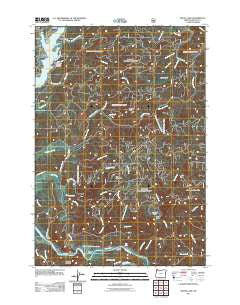
~ Devils Lake OR topo map, 1:24000 scale, 7.5 X 7.5 Minute, Historical, 2011
Devils Lake, Oregon, USGS topographic map dated 2011.
Includes geographic coordinates (latitude and longitude). This topographic map is suitable for hiking, camping, and exploring, or framing it as a wall map.
Printed on-demand using high resolution imagery, on heavy weight and acid free paper, or alternatively on a variety of synthetic materials.
Topos available on paper, Waterproof, Poly, or Tyvek. Usually shipping rolled, unless combined with other folded maps in one order.
- Product Number: USGS-5332226
- Free digital map download (high-resolution, GeoPDF): Devils Lake, Oregon (file size: 26 MB)
- Map Size: please refer to the dimensions of the GeoPDF map above
- Weight (paper map): ca. 55 grams
- Map Type: POD USGS Topographic Map
- Map Series: US Topo
- Map Verison: Historical
- Cell ID: 12106
- Datum: North American Datum of 1983
- Map Projection: Transverse Mercator
- Map Cell Name: Devils Lake
- Grid size: 7.5 X 7.5 Minute
- Date on map: 2011
- Map Scale: 1:24000
- Geographical region: Oregon, United States
Neighboring Maps:
All neighboring USGS topo maps are available for sale online at a variety of scales.
Spatial coverage:
Topo map Devils Lake, Oregon, covers the geographical area associated the following places:
- Wildcat Creek - Fall Creek - Lincoln City - Schooner Creek Water Treatment Plant - Blue Heron Boat Landing - North Fork Schooner Creek - Bluff Creek - Barhaven Creek - Thompson Creek - North Lincoln Fire and Rescue District 1 Station 1700 Kernville - Ball Mountain - Medicine Rock - Cannery Mountain - East Fork Quarry Creek - Devils Lake - KBCH-AM - Tarry Creek - Echo Falls - The Loop - Holmes Road Park - East Devils Lake State Park Boat Ramp - Odell Creek - Lake Point - Department of Motor Vehicles Lincoln City - Abrams Creek - Regatta Park - Pikes Camp - Bear Creek - Erickson Creek - Elos Prairie - Schooner Creek Campground (historical) - Lincoln City Division - Coyote Rock RV Park Boat Ramp - Blue Heron Dock - Reed Reservoir - Chinook Bend - Baldy Creek Quarry - Samaritan North Lincoln Hospital - Drift Creek Trail - Oceanlake Dam - Bones Creek - Sportsmans Landing - Drift Creek County Park - Drift Creek Bridge (historical) - North Creek Campground (historical) - Sunset Landing - Sunset Landing - Coyote Rock RV Park - Regatta Grounds Park Boat Ramp - Samaritan North Lincoln Hospital Heliport - Gordey Creek - Pacific West Ambulance - Southman Creek - Skunk Creek - Sand Point Boat Launch - Callow Creek - Deadwood Mountain - Pacific View Memorial Gardens - Anderson Creek - South Fork Schooner Creek - Coyote Rock - Drift Creek Camp - Wildcat Creek - Kernville - Gleneden Beach - Lincoln Beach Water District Water Treatment Plant - North Creek - Sunset Landing - Quarry Creek - Prairie Hill
- Map Area ID: AREA4544.875-124-123.875
- Northwest corner Lat/Long code: USGSNW45-124
- Northeast corner Lat/Long code: USGSNE45-123.875
- Southwest corner Lat/Long code: USGSSW44.875-124
- Southeast corner Lat/Long code: USGSSE44.875-123.875
- Northern map edge Latitude: 45
- Southern map edge Latitude: 44.875
- Western map edge Longitude: -124
- Eastern map edge Longitude: -123.875


