
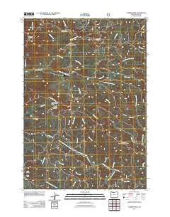
~ Cummins Peak OR topo map, 1:24000 scale, 7.5 X 7.5 Minute, Historical, 2011
Cummins Peak, Oregon, USGS topographic map dated 2011.
Includes geographic coordinates (latitude and longitude). This topographic map is suitable for hiking, camping, and exploring, or framing it as a wall map.
Printed on-demand using high resolution imagery, on heavy weight and acid free paper, or alternatively on a variety of synthetic materials.
Topos available on paper, Waterproof, Poly, or Tyvek. Usually shipping rolled, unless combined with other folded maps in one order.
- Product Number: USGS-5332224
- Free digital map download (high-resolution, GeoPDF): Cummins Peak, Oregon (file size: 30 MB)
- Map Size: please refer to the dimensions of the GeoPDF map above
- Weight (paper map): ca. 55 grams
- Map Type: POD USGS Topographic Map
- Map Series: US Topo
- Map Verison: Historical
- Cell ID: 11028
- Datum: North American Datum of 1983
- Map Projection: Transverse Mercator
- Map Cell Name: Cummins Peak
- Grid size: 7.5 X 7.5 Minute
- Date on map: 2011
- Map Scale: 1:24000
- Geographical region: Oregon, United States
Neighboring Maps:
All neighboring USGS topo maps are available for sale online at a variety of scales.
Spatial coverage:
Topo map Cummins Peak, Oregon, covers the geographical area associated the following places:
- Saddle Mountain - Clover Camp - Cummins Peak - West Branch North Fork Siuslaw River - Wildcat Creek - Klickitat Mountain - Maria Creek - Klickitat Quarry - Pawn - Lawrence Creek - Formander Ridge - Madera Grave - Three Buttes - Left Fork Wilhelm Creek - Saddle Mountain Springs - Cedar Creek - Taylor Creek - Grizzly Ridge - Pawn Post Office (historical) - South Fork Tenmile Creek - Rogers Creek - Klickitat Ridge - McKinney Creek - West Branch Sam Creek - Cummins Peak Weather Station - Cullen Creek - Pyle Creek - Elma Creek - Sam Creek
- Map Area ID: AREA44.2544.125-124-123.875
- Northwest corner Lat/Long code: USGSNW44.25-124
- Northeast corner Lat/Long code: USGSNE44.25-123.875
- Southwest corner Lat/Long code: USGSSW44.125-124
- Southeast corner Lat/Long code: USGSSE44.125-123.875
- Northern map edge Latitude: 44.25
- Southern map edge Latitude: 44.125
- Western map edge Longitude: -124
- Eastern map edge Longitude: -123.875


