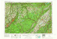
~ Scranton PA topo map, 1:250000 scale, 1 X 2 Degree, Historical, 1965
Scranton, Pennsylvania, USGS topographic map dated 1965.
Includes geographic coordinates (latitude and longitude). This topographic map is suitable for hiking, camping, and exploring, or framing it as a wall map.
Printed on-demand using high resolution imagery, on heavy weight and acid free paper, or alternatively on a variety of synthetic materials.
Topos available on paper, Waterproof, Poly, or Tyvek. Usually shipping rolled, unless combined with other folded maps in one order.
- Product Number: USGS-5332064
- Free digital map download (high-resolution, GeoPDF): Scranton, Pennsylvania (file size: 20 MB)
- Map Size: please refer to the dimensions of the GeoPDF map above
- Weight (paper map): ca. 55 grams
- Map Type: POD USGS Topographic Map
- Map Series: HTMC
- Map Verison: Historical
- Cell ID: 69021
- Scan ID: 221787
- Woodland Tint: Yes
- Aerial Photo Year: 1962
- Field Check Year: 1962
- Datum: Unstated
- Map Projection: Transverse Mercator
- Map published by United States Army Corps of Engineers
- Map published by United States Army
- Map Language: English
- Scanner Resolution: 600 dpi
- Map Cell Name: Scranton
- Grid size: 1 X 2 Degree
- Date on map: 1965
- Map Scale: 1:250000
- Geographical region: Pennsylvania, United States
Neighboring Maps:
All neighboring USGS topo maps are available for sale online at a variety of scales.
Spatial coverage:
Topo map Scranton, Pennsylvania, covers the geographical area associated the following places:
- Childs - Greenville - Lake Wallenpaupack Estate - Potterville - Fremont Center - Saint Andrew - Glen Summit - East Chester - Ararat - Big Island - Oakland - Oliver Mills - Sparta Junction - Lake Osiris Colony - Stewart Terrace - Forest Lake - Castle High Estates - Crandon Lakes - Lakewood Estates Mobile Home Park - Cottekill - Warnertown - Chestnut Ridge - Pocono Farms East - Dyberry - Libertyville - Bohemia - Beach Lake - Greeley - Jockey Hill - Mount Hope - Hanford - North Jackson - Brooklyn - Choconut - Falls - Mountain Top - Blooming Grove - Ketcham - Allendale - Huguenot - Debruce - Holiday Pocono - Ulster Heights - Warwick - New Milford - Lemon - Butterville - Ringwood - Walker Valley - Wangaum - Bridgeport - Monroe - Pine Bush - Parish Lane Mobile Home Park - Smiths Mills - Franklin Forks - Niagara - Ackermans Mills - Winterton - Ridgewood - The Hideout - Witinski Villa - Hillside - Green Pond - South Centerville - Schultzville - Port Jervis - Carpenter Town - Herrick Corner - Chapman Lake - Kipps - Sawkill - Cortez - Blakeslee - Tanglewood Estate - Browntown - Obernburg - Myrtle Grove - Claryville - Pocono Springs - Birchwood Lakes - Cragmere Park - Forest Glen - Marbletown - Dingmans Ferry - Swoyersville - Pocono Laurel Lake - Black Lake - Sparta - Mount Pisgah - Sand Spring - Monticello - Abrahamsville - Pink - Lower Askam - Orange Lake - Amity - Little Summit - Roses Point - East Spruce
- Map Area ID: AREA4241-76-74
- Northwest corner Lat/Long code: USGSNW42-76
- Northeast corner Lat/Long code: USGSNE42-74
- Southwest corner Lat/Long code: USGSSW41-76
- Southeast corner Lat/Long code: USGSSE41-74
- Northern map edge Latitude: 42
- Southern map edge Latitude: 41
- Western map edge Longitude: -76
- Eastern map edge Longitude: -74

