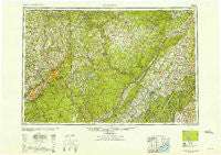
~ Scranton PA topo map, 1:250000 scale, 1 X 2 Degree, Historical, 1953
Scranton, Pennsylvania, USGS topographic map dated 1953.
Includes geographic coordinates (latitude and longitude). This topographic map is suitable for hiking, camping, and exploring, or framing it as a wall map.
Printed on-demand using high resolution imagery, on heavy weight and acid free paper, or alternatively on a variety of synthetic materials.
Topos available on paper, Waterproof, Poly, or Tyvek. Usually shipping rolled, unless combined with other folded maps in one order.
- Product Number: USGS-5332060
- Free digital map download (high-resolution, GeoPDF): Scranton, Pennsylvania (file size: 19 MB)
- Map Size: please refer to the dimensions of the GeoPDF map above
- Weight (paper map): ca. 55 grams
- Map Type: POD USGS Topographic Map
- Map Series: HTMC
- Map Verison: Historical
- Cell ID: 69021
- Scan ID: 221784
- Woodland Tint: Yes
- Aerial Photo Year: 1944
- Datum: NAD27
- Map Projection: Transverse Mercator
- Map published by United States Army Corps of Engineers
- Map published by United States Army
- Map Language: English
- Scanner Resolution: 600 dpi
- Map Cell Name: Scranton
- Grid size: 1 X 2 Degree
- Date on map: 1953
- Map Scale: 1:250000
- Geographical region: Pennsylvania, United States
Neighboring Maps:
All neighboring USGS topo maps are available for sale online at a variety of scales.
Spatial coverage:
Topo map Scranton, Pennsylvania, covers the geographical area associated the following places:
- Big Bass Lake - Dickson City - Red Oak - Spring Glen - Brushville - Martins - Rileyville - Barryville - Carley Brook - Otisville - Wigwam Lake Estates - Ferndale - Auburn Four Corners - Washington Heights - Ferdinands Mills - Long Eddy - Cahoonzie - Great Bend - Sand Spring - Towamensing Trails - Parksville - Mount Prosper - Stockport - Preston Corner - Delaware - Kipps - Washington Mobile Home Park - East Sterling - Mohonk Lake - Beech Grove - Ransom - Preston - Old Boston - McCartys Corner - Moosic - Gardnertown - McAfee - Cooley - Tuthilltown - Depew Mobile Home Park - Lake Huntington - Little York - Mileses - Van Burenville - Mill City - Sunrise Mobile Home Park - Mount Vernon - Tabasco - Wanaque-Midvale - Vandling - Maple Glen - Bloomington - Bloomingdale - Cornwall-on-Hudson - Ackerson - Fallsdale - Gravel Place - Keystone Park - Blue Sky Manor Mobile Home Park - Union Dale - Northrup - Hopkins Corner - Pine Island - Morgan Hill - Bulsontown - Franklin Grove - Hurleyville - Port Blanchard - Jenkinstown - Mountain Top Estates - Sugar Notch - Parkston - Hardwick - Uttertown - New Paltz - Mombaccus - Ireland Corners - Fairview - Lapla - Campbell Hall Junction - Johnson Greene - Wesley Hills - Hampton Trails - Winchell - Parkers Glen - Henryville - Winona Lakes - Springdale - Lower Askam - Watchtower - Phillipsburg - Tafton - Fortenia - Westbrookville - Pocono Pines - La Anna - Olwen Heights - Pellettown - Dickville - Viola
- Map Area ID: AREA4241-76-74
- Northwest corner Lat/Long code: USGSNW42-76
- Northeast corner Lat/Long code: USGSNE42-74
- Southwest corner Lat/Long code: USGSSW41-76
- Southeast corner Lat/Long code: USGSSE41-74
- Northern map edge Latitude: 42
- Southern map edge Latitude: 41
- Western map edge Longitude: -76
- Eastern map edge Longitude: -74

