
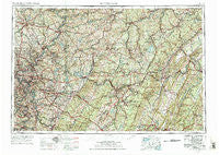
~ Pittsburgh PA topo map, 1:250000 scale, 1 X 2 Degree, Historical, 1958, updated 1975
Pittsburgh, Pennsylvania, USGS topographic map dated 1958.
Includes geographic coordinates (latitude and longitude). This topographic map is suitable for hiking, camping, and exploring, or framing it as a wall map.
Printed on-demand using high resolution imagery, on heavy weight and acid free paper, or alternatively on a variety of synthetic materials.
Topos available on paper, Waterproof, Poly, or Tyvek. Usually shipping rolled, unless combined with other folded maps in one order.
- Product Number: USGS-5332054
- Free digital map download (high-resolution, GeoPDF): Pittsburgh, Pennsylvania (file size: 22 MB)
- Map Size: please refer to the dimensions of the GeoPDF map above
- Weight (paper map): ca. 55 grams
- Map Type: POD USGS Topographic Map
- Map Series: HTMC
- Map Verison: Historical
- Cell ID: 68961
- Scan ID: 221431
- Imprint Year: 1975
- Woodland Tint: Yes
- Visual Version Number: 1
- Aerial Photo Year: 1958
- Edit Year: 1969
- Datum: Unstated
- Map Projection: Transverse Mercator
- Map published by: Military, Other
- Map Language: English
- Scanner Resolution: 600 dpi
- Map Cell Name: Pittsburgh
- Grid size: 1 X 2 Degree
- Date on map: 1958
- Map Scale: 1:250000
- Geographical region: Pennsylvania, United States
Neighboring Maps:
All neighboring USGS topo maps are available for sale online at a variety of scales.
Spatial coverage:
Topo map Pittsburgh, Pennsylvania, covers the geographical area associated the following places:
- Flowing Spring - Jones Mills - Orville - Pine Top - Smeltzer - Hazel Kirk - Crete - Pleasant Valley - Cush Cushion Crossing - Upper Dutchtown - Bloomfield - Morrisons Cove - Birmingham - Red Mill - Cardiff - Woodbury - Nadine - Standard Shaft - Sherrett - Goods Corner - Old Crabtree - Armbrust - Two Lick - Loretto Road - Etna Furnace - Sample Run - Walnut Hill - Godfrey - Richland - Moween - Herminie Number 2 - Pandora - Coalmont - Ehrenfeld - Boltz - Wissingertown - Saint Vincent Shaft - Sterling - McFann - Cherry City - Mount Oliver - Barking - Snowden - Lovely - Binnstown - Melcroft - Pindleton - Bovard - North Washington - Orners Corner - Old Stanton - Pittsburgh - Tripoli - Beaverton - Coal Valley - Timblin - Waterfall - Hooker - Taylor Highlands - Spring Church - Mustard - Glade Mills - Loop - Ribot - Herman - Eichelbergertown - Centerville (historical) - Nihil - Gill Hall - Tidal - Foxtown - Big Run - North Butler - Franklin - Seven Springs - Meadowood - Romney - Jefferson Hills - White - Fiddlers Green - Hillman - Poplar Grove - Widnoon - Lowber - Hollentown - Pleasant Hill - Kepples Corners - Hastings - East End - Booker - Adrian - Bens Creek - Bradenville - Mount Olive - McConnellstown - Gatesburg - Lincoln - Carbon Center - Springdale - Grampian
- Map Area ID: AREA4140-80-78
- Northwest corner Lat/Long code: USGSNW41-80
- Northeast corner Lat/Long code: USGSNE41-78
- Southwest corner Lat/Long code: USGSSW40-80
- Southeast corner Lat/Long code: USGSSE40-78
- Northern map edge Latitude: 41
- Southern map edge Latitude: 40
- Western map edge Longitude: -80
- Eastern map edge Longitude: -78


