
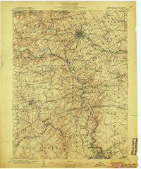
~ West Chester PA topo map, 1:62500 scale, 15 X 15 Minute, Historical, 1904
West Chester, Pennsylvania, USGS topographic map dated 1904.
Includes geographic coordinates (latitude and longitude). This topographic map is suitable for hiking, camping, and exploring, or framing it as a wall map.
Printed on-demand using high resolution imagery, on heavy weight and acid free paper, or alternatively on a variety of synthetic materials.
Topos available on paper, Waterproof, Poly, or Tyvek. Usually shipping rolled, unless combined with other folded maps in one order.
- Product Number: USGS-5331818
- Free digital map download (high-resolution, GeoPDF): West Chester, Pennsylvania (file size: 10 MB)
- Map Size: please refer to the dimensions of the GeoPDF map above
- Weight (paper map): ca. 55 grams
- Map Type: POD USGS Topographic Map
- Map Series: HTMC
- Map Verison: Historical
- Cell ID: 64403
- Scan ID: 170091
- Survey Year: 1901
- Datum: Unstated
- Map Projection: Unstated
- Map published by United States Geological Survey
- Map Language: English
- Scanner Resolution: 600 dpi
- Map Cell Name: West Chester
- Grid size: 15 X 15 Minute
- Date on map: 1904
- Map Scale: 1:62500
- Geographical region: Pennsylvania, United States
Neighboring Maps:
All neighboring USGS topo maps are available for sale online at a variety of scales.
Spatial coverage:
Topo map West Chester, Pennsylvania, covers the geographical area associated the following places:
- Willowdale - Westmont - Monroe Park - Charter Oaks - Pamona Park - Embreeville - Brookhill Farms - Cameron Hills - Suburban Village - Gumwood - Coffee Run - Woodcock Farm - Oak Lane Manor - Hilloch Manor - Birmingham - Welshire - Longwood - Penarth - Twin Turns Farm - Markham - Ainsley Woods - Blue Rock Manor - Worington Commons - Colonial Woods - Tanguy - Unionville - Brookfield - Westbrite - Galewood - Ebright - Marlboro - Hickory Ridge - Stonehaven - Green Meadow - Coventry Village - Carrcroft Crest - Mendenhall Village - Pembrey - Tenby Chase - Copesville - Centerville - Wynnewood - Sedgley Farms - Westtown Park - Sharpless Farms - Land Grant Farms - Thornton - Pennington Farm - Normandy Manor - Silverbrook - Talleyville - Windon - Beaver Valley - Deer Pointe - Rock Manor - Jerrehian Estates - Wylie Farms - Jarrell Farms - Centreville Tract - Meeting House Hill - Bellefonte - Hampton - Granogue - Bridleshire Farms - Hyllwynd - The Knolls of Birmingham - Smithfield Estates - Birmingham Hunt - Glenhall - Rosedale - Church Hill - Delwynn - Pennwood South - Westmount - Bella Vista - Tree Top Valley - Gallagherville - Gateway Farms - Devonshire - Greenville Place - West Wynn - Dutts Mill - Greenville Development - Green Hill - Burnt Mills - Saverys Mill - Winterset Farms - Cossart Creek - Iron Gates - Horseshoe Hill - Quail Ridge - Brandon - Windsor Hills - Blue Ball - Delwoods - Larchmont - Keepsake - Northbrook - Thornbury Hunt - Meadowbrook
- Map Area ID: AREA4039.75-75.75-75.5
- Northwest corner Lat/Long code: USGSNW40-75.75
- Northeast corner Lat/Long code: USGSNE40-75.5
- Southwest corner Lat/Long code: USGSSW39.75-75.75
- Southeast corner Lat/Long code: USGSSE39.75-75.5
- Northern map edge Latitude: 40
- Southern map edge Latitude: 39.75
- Western map edge Longitude: -75.75
- Eastern map edge Longitude: -75.5


