
~ Bushkill PA topo map, 1:62500 scale, 15 X 15 Minute, Historical, 1943, updated 1943
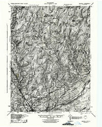
Bushkill, Pennsylvania, USGS topographic map dated 1943.
Includes geographic coordinates (latitude and longitude). This topographic map is suitable for hiking, camping, and exploring, or framing it as a wall map.
Printed on-demand using high resolution imagery, on heavy weight and acid free paper, or alternatively on a variety of synthetic materials.
Topos available on paper, Waterproof, Poly, or Tyvek. Usually shipping rolled, unless combined with other folded maps in one order.
- Product Number: USGS-5329564
- Free digital map download (high-resolution, GeoPDF): Bushkill, Pennsylvania (file size: 11 MB)
- Map Size: please refer to the dimensions of the GeoPDF map above
- Weight (paper map): ca. 55 grams
- Map Type: POD USGS Topographic Map
- Map Series: HTMC
- Map Verison: Historical
- Cell ID: 51959
- Scan ID: 172769
- Imprint Year: 1943
- Aerial Photo Year: 1939
- Survey Year: 1924
- Datum: NAD
- Map Projection: Polyconic
- Map published by United States Army Corps of Engineers
- Map published by United States Army
- Map published by United States Department of War
- Keywords: Nonstandard Press Run
- Map Language: English
- Scanner Resolution: 600 dpi
- Map Cell Name: Bushkill
- Grid size: 15 X 15 Minute
- Date on map: 1943
- Map Scale: 1:62500
- Geographical region: Pennsylvania, United States
Neighboring Maps:
All neighboring USGS topo maps are available for sale online at a variety of scales.
Spatial coverage:
Topo map Bushkill, Pennsylvania, covers the geographical area associated the following places:
- Calno - Frutchey - Craigs Meadow - Oak Grove - Marshalls Creek - Bushkill - Penn Estates - Red Ledge Manor Estates - Gravel Place - Spruce Hill - Sandyville - Minisink Hills - Snow Hill Falls - Wooddale - Forest Park - Pine Flats - Castle Rock Acres - Wilderness Acres - Pocono Heights - Poplar Bridge - North Water Gap - Skytop - Echo Lake - Henryville - Analomink - Coolbaugh - Shoemakers - Saw Creek - Kahkhout Mountain - Turn Villa - Mount Zion - Mountain Top Estates - Winona Lakes - Resica Falls - Tamiment - Shawnee on Delaware - Easton Anglers - Monroe Lake - Winona Lakes
- Map Area ID: AREA41.2541-75.25-75
- Northwest corner Lat/Long code: USGSNW41.25-75.25
- Northeast corner Lat/Long code: USGSNE41.25-75
- Southwest corner Lat/Long code: USGSSW41-75.25
- Southeast corner Lat/Long code: USGSSE41-75
- Northern map edge Latitude: 41.25
- Southern map edge Latitude: 41
- Western map edge Longitude: -75.25
- Eastern map edge Longitude: -75


