
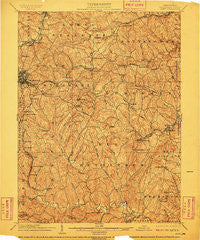
~ Amity PA topo map, 1:62500 scale, 15 X 15 Minute, Historical, 1904, updated 1910
Amity, Pennsylvania, USGS topographic map dated 1904.
Includes geographic coordinates (latitude and longitude). This topographic map is suitable for hiking, camping, and exploring, or framing it as a wall map.
Printed on-demand using high resolution imagery, on heavy weight and acid free paper, or alternatively on a variety of synthetic materials.
Topos available on paper, Waterproof, Poly, or Tyvek. Usually shipping rolled, unless combined with other folded maps in one order.
- Product Number: USGS-5329340
- Free digital map download (high-resolution, GeoPDF): Amity, Pennsylvania (file size: 13 MB)
- Map Size: please refer to the dimensions of the GeoPDF map above
- Weight (paper map): ca. 55 grams
- Map Type: POD USGS Topographic Map
- Map Series: HTMC
- Map Verison: Historical
- Cell ID: 50524
- Scan ID: 169782
- Imprint Year: 1910
- Survey Year: 1902
- Datum: Unstated
- Map Projection: Unstated
- Map published by United States Geological Survey
- Map Language: English
- Scanner Resolution: 600 dpi
- Map Cell Name: Amity
- Grid size: 15 X 15 Minute
- Date on map: 1904
- Map Scale: 1:62500
- Geographical region: Pennsylvania, United States
Neighboring Maps:
All neighboring USGS topo maps are available for sale online at a variety of scales.
Spatial coverage:
Topo map Amity, Pennsylvania, covers the geographical area associated the following places:
- Kammerer - Baker Station - Enterprise - West Zollarsville - Wylandville - Munntown - Conger - North Fredericktown - West Amity - Ellsworth - Clokeyville (historical) - Washington - East Marianna - Vanceville - Bentleyville - Pleasant View Heights - Mount Pleasant - Allison Park - Rich Hill - Condit Crossing - Chambers Mill - Odell - Old Zollarsville - Mount Herman - Moniger Heights - Bakers - Fredericktown Hill - Cokeburg - Richeyville - Vance - Ringlands - McGovern - Banetown - Thomas - Beallsville - Fairfield - Hill Church - South Strabane - Marianna - Manifold - Glyde - Emery - Deemston - Turkeyfoot - Laboratory - Scenery Hill - Ontario - Meadow Lands - Braddock - Boon Terrace - Farquhar - Houston - Zediker - Hackett - Little Summit - Venetia - Eighty Four - Gilkeson - Lone Pine - Hillsboro - Ten Mile - Bissell - McCracken - Long Pine - East Washington - Moninger - Cokeburg Junction - Amity - Hackney - Linden - Van Voorhis Hill - Vankirk - Dunningsville - Shingiss - Gambles
- Map Area ID: AREA40.2540-80.25-80
- Northwest corner Lat/Long code: USGSNW40.25-80.25
- Northeast corner Lat/Long code: USGSNE40.25-80
- Southwest corner Lat/Long code: USGSSW40-80.25
- Southeast corner Lat/Long code: USGSSE40-80
- Northern map edge Latitude: 40.25
- Southern map edge Latitude: 40
- Western map edge Longitude: -80.25
- Eastern map edge Longitude: -80


