
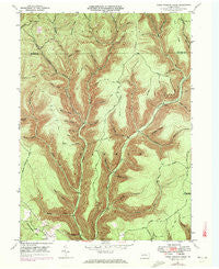
~ Young Womans Creek PA topo map, 1:24000 scale, 7.5 X 7.5 Minute, Historical, 1946, updated 1972
Young Womans Creek, Pennsylvania, USGS topographic map dated 1946.
Includes geographic coordinates (latitude and longitude). This topographic map is suitable for hiking, camping, and exploring, or framing it as a wall map.
Printed on-demand using high resolution imagery, on heavy weight and acid free paper, or alternatively on a variety of synthetic materials.
Topos available on paper, Waterproof, Poly, or Tyvek. Usually shipping rolled, unless combined with other folded maps in one order.
- Product Number: USGS-5329038
- Free digital map download (high-resolution, GeoPDF): Young Womans Creek, Pennsylvania (file size: 14 MB)
- Map Size: please refer to the dimensions of the GeoPDF map above
- Weight (paper map): ca. 55 grams
- Map Type: POD USGS Topographic Map
- Map Series: HTMC
- Map Verison: Historical
- Cell ID: 50155
- Scan ID: 222633
- Imprint Year: 1972
- Woodland Tint: Yes
- Photo Revision Year: 1971
- Aerial Photo Year: 1971
- Field Check Year: 1946
- Datum: NAD27
- Map Projection: Polyconic
- Map published by United States Geological Survey
- Map Language: English
- Scanner Resolution: 600 dpi
- Map Cell Name: Young Womans Creek
- Grid size: 7.5 X 7.5 Minute
- Date on map: 1946
- Map Scale: 1:24000
- Geographical region: Pennsylvania, United States
Neighboring Maps:
All neighboring USGS topo maps are available for sale online at a variety of scales.
Spatial coverage:
Topo map Young Womans Creek, Pennsylvania, covers the geographical area associated the following places:
- Lecox Ridge - Fye Camp Trail - Laurelly Hill Trail - Morgan Hollow Trail - Geyser Hollow - McCraney Run - Butler Hollow - Bull Run - Dug Road Trail - Post Hollow - Little Greenlick Run - Mudlick Trail - Calamity Hollow - Oxbow Hollow Trail - Shingle Branch - Ginseng Hollow - Stout Hollow Trail - Greenlick Run - Stible Hole Trail - Oxbow Hollow - Daugherty Hollow Trail - Merriman Hollow - Bee Tree Hollow - Quiggle Hollow - Poplar Hollow - Shingle Mill Hollow Trail - Italian Hollow Trail - Ash Hollow - Birch Hollow - Stout Hollow - Wildcat Trail - Rattlesnake Trail - Little Boyer Mill Trail - Shaney Brook - Ash Hollow Trail - Beechwood Trail - Daugherty Hollow - Camp Trail - Tegerman Hollow - French Trail - Long Hollow - Patchell Trail - Summerson Mountain - Cannon Hole Trail - Mudlick Run - Lee Hollow Trail - Spring Brook - Rands Hole Trail - Mix Hollow Trail - Shaney Brook Trail - Fork Hill Trail - Long Fork Trail - Township of Chapman - Big Spring Branch - Laurel Fork - Laurel Ridge - Ingram Hollow - Lecox Ridge Trail - Laurelly Fork - Lebo Run - Summerson Run
- Map Area ID: AREA41.541.375-77.75-77.625
- Northwest corner Lat/Long code: USGSNW41.5-77.75
- Northeast corner Lat/Long code: USGSNE41.5-77.625
- Southwest corner Lat/Long code: USGSSW41.375-77.75
- Southeast corner Lat/Long code: USGSSE41.375-77.625
- Northern map edge Latitude: 41.5
- Southern map edge Latitude: 41.375
- Western map edge Longitude: -77.75
- Eastern map edge Longitude: -77.625


