
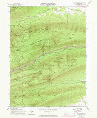
~ Williamsport SE PA topo map, 1:24000 scale, 7.5 X 7.5 Minute, Historical, 1965, updated 1973
Williamsport SE, Pennsylvania, USGS topographic map dated 1965.
Includes geographic coordinates (latitude and longitude). This topographic map is suitable for hiking, camping, and exploring, or framing it as a wall map.
Printed on-demand using high resolution imagery, on heavy weight and acid free paper, or alternatively on a variety of synthetic materials.
Topos available on paper, Waterproof, Poly, or Tyvek. Usually shipping rolled, unless combined with other folded maps in one order.
- Product Number: USGS-5328920
- Free digital map download (high-resolution, GeoPDF): Williamsport SE, Pennsylvania (file size: 11 MB)
- Map Size: please refer to the dimensions of the GeoPDF map above
- Weight (paper map): ca. 55 grams
- Map Type: POD USGS Topographic Map
- Map Series: HTMC
- Map Verison: Historical
- Cell ID: 49186
- Scan ID: 222563
- Imprint Year: 1973
- Woodland Tint: Yes
- Photo Revision Year: 1973
- Aerial Photo Year: 1973
- Field Check Year: 1965
- Datum: NAD27
- Map Projection: Polyconic
- Map published by United States Geological Survey
- Map Language: English
- Scanner Resolution: 600 dpi
- Map Cell Name: Williamsport SE
- Grid size: 7.5 X 7.5 Minute
- Date on map: 1965
- Map Scale: 1:24000
- Geographical region: Pennsylvania, United States
Neighboring Maps:
All neighboring USGS topo maps are available for sale online at a variety of scales.
Spatial coverage:
Topo map Williamsport SE, Pennsylvania, covers the geographical area associated the following places:
- Spruce Gap - Keystone Camp (historical) - Kettle Hole - Metzger Trail - Glen Cabin Gap - Running Gap - Lick Run Trail - Stony Gap - Long Knob - Fourth Gap - Lyman Gap - Top Mountain Trail - Pine Flat - First Gap - Sheet Iron Trail - Milton Camp (historical) - Shoemaker Knob - Kurtz Gap - Fawn Ridge - Mile Run - Lick Run - Grosses Gap Trail - Lyman Gap Trail - Kurtz Gap Trail - Lick Run - Third Gap Trail - Sand Spring Run - Kettle Hole Trail - Beartrap Hollow - Township of Washington - Mile Run Trail - Second Gap - Sand Spring Camp - Little Mountain - Potato Hill - Bear Gap - Third Gap - Second Gap Trail - Buck Path Trail - Pine Flat Trail - Hoffa Trail - Mile Run Camp - Glen Cabin Trail - Buffalo Mountain - Mud Hole Trail - Webster Trail - Round Knob - Cowbell Hollow - Bear Gap Trail - Buffalo Mountain Trail - Clark Trail - Cowbell Hollow Trail - Lake Trail - South White Deer Ridge
- Map Area ID: AREA41.12541-77.125-77
- Northwest corner Lat/Long code: USGSNW41.125-77.125
- Northeast corner Lat/Long code: USGSNE41.125-77
- Southwest corner Lat/Long code: USGSSW41-77.125
- Southeast corner Lat/Long code: USGSSE41-77
- Northern map edge Latitude: 41.125
- Southern map edge Latitude: 41
- Western map edge Longitude: -77.125
- Eastern map edge Longitude: -77


