
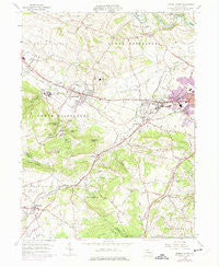
~ Sinking Spring PA topo map, 1:24000 scale, 7.5 X 7.5 Minute, Historical, 1955, updated 1975
Sinking Spring, Pennsylvania, USGS topographic map dated 1955.
Includes geographic coordinates (latitude and longitude). This topographic map is suitable for hiking, camping, and exploring, or framing it as a wall map.
Printed on-demand using high resolution imagery, on heavy weight and acid free paper, or alternatively on a variety of synthetic materials.
Topos available on paper, Waterproof, Poly, or Tyvek. Usually shipping rolled, unless combined with other folded maps in one order.
- Product Number: USGS-5327698
- Free digital map download (high-resolution, GeoPDF): Sinking Spring, Pennsylvania (file size: 11 MB)
- Map Size: please refer to the dimensions of the GeoPDF map above
- Weight (paper map): ca. 55 grams
- Map Type: POD USGS Topographic Map
- Map Series: HTMC
- Map Verison: Historical
- Cell ID: 41486
- Scan ID: 221834
- Imprint Year: 1975
- Woodland Tint: Yes
- Photo Revision Year: 1968
- Aerial Photo Year: 1968
- Field Check Year: 1955
- Datum: NAD27
- Map Projection: Polyconic
- Map published by United States Geological Survey
- Map Language: English
- Scanner Resolution: 600 dpi
- Map Cell Name: Sinking Spring
- Grid size: 7.5 X 7.5 Minute
- Date on map: 1955
- Map Scale: 1:24000
- Geographical region: Pennsylvania, United States
Neighboring Maps:
All neighboring USGS topo maps are available for sale online at a variety of scales.
Spatial coverage:
Topo map Sinking Spring, Pennsylvania, covers the geographical area associated the following places:
- Tallowyck - Whitfield - Wilshire Hills - Highland - Reinholds - Spring Dale Heights - Blue Marsh (historical) - Phoebe Berks Village - Gouglersville - Colonial Hills - Vera Cruz - Vinemont - Grings Hill Estates - Sinking Spring - State Hill - Wheaton Heights - Sinking Spring Terrace - Brownsville - Mohns Hill - Shiloh Hills - Green Valley Gardens - Green Valley Estates - Fritztown - Montello - Cornwall Terrace - Villa Maria Infirmary - Cacoosing - Wernersville
- Map Area ID: AREA40.37540.25-76.125-76
- Northwest corner Lat/Long code: USGSNW40.375-76.125
- Northeast corner Lat/Long code: USGSNE40.375-76
- Southwest corner Lat/Long code: USGSSW40.25-76.125
- Southeast corner Lat/Long code: USGSSE40.25-76
- Northern map edge Latitude: 40.375
- Southern map edge Latitude: 40.25
- Western map edge Longitude: -76.125
- Eastern map edge Longitude: -76


