
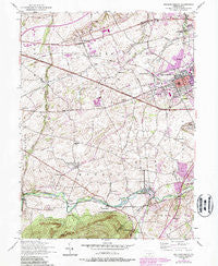
~ Mechanicsburg PA topo map, 1:24000 scale, 7.5 X 7.5 Minute, Historical, 1952, updated 1987
Mechanicsburg, Pennsylvania, USGS topographic map dated 1952.
Includes geographic coordinates (latitude and longitude). This topographic map is suitable for hiking, camping, and exploring, or framing it as a wall map.
Printed on-demand using high resolution imagery, on heavy weight and acid free paper, or alternatively on a variety of synthetic materials.
Topos available on paper, Waterproof, Poly, or Tyvek. Usually shipping rolled, unless combined with other folded maps in one order.
- Product Number: USGS-5325748
- Free digital map download (high-resolution, GeoPDF): Mechanicsburg, Pennsylvania (file size: 12 MB)
- Map Size: please refer to the dimensions of the GeoPDF map above
- Weight (paper map): ca. 55 grams
- Map Type: POD USGS Topographic Map
- Map Series: HTMC
- Map Verison: Historical
- Cell ID: 28616
- Scan ID: 222713
- Imprint Year: 1987
- Woodland Tint: Yes
- Photo Revision Year: 1987
- Aerial Photo Year: 1984
- Edit Year: 1987
- Field Check Year: 1952
- Datum: NAD27
- Map Projection: Polyconic
- Map published by United States Geological Survey
- Map published by United States Army
- Map Language: English
- Scanner Resolution: 600 dpi
- Map Cell Name: Mechanicsburg
- Grid size: 7.5 X 7.5 Minute
- Date on map: 1952
- Map Scale: 1:24000
- Geographical region: Pennsylvania, United States
Neighboring Maps:
All neighboring USGS topo maps are available for sale online at a variety of scales.
Spatial coverage:
Topo map Mechanicsburg, Pennsylvania, covers the geographical area associated the following places:
- Leidighs - Mechanicsburg - Williams Grove - Country Estates - Locust Point - Sunnyland - Webercroft - Liebys Trailer Park - Roxbury - Rosegarden - Trindle Springs - Berkshire Hills - Allen - Churchtown - Rose Garden - New Kingstown - White Rock Acres - Kingtown - Carroll Manor - Brandtsville - Valley Stream Estates - Dillsburg Junction - Hogestown - Le High Park
- Map Area ID: AREA40.2540.125-77.125-77
- Northwest corner Lat/Long code: USGSNW40.25-77.125
- Northeast corner Lat/Long code: USGSNE40.25-77
- Southwest corner Lat/Long code: USGSSW40.125-77.125
- Southeast corner Lat/Long code: USGSSE40.125-77
- Northern map edge Latitude: 40.25
- Southern map edge Latitude: 40.125
- Western map edge Longitude: -77.125
- Eastern map edge Longitude: -77


