
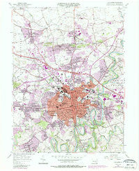
~ Lancaster PA topo map, 1:24000 scale, 7.5 X 7.5 Minute, Historical, 1956, updated 1987
Lancaster, Pennsylvania, USGS topographic map dated 1956.
Includes geographic coordinates (latitude and longitude). This topographic map is suitable for hiking, camping, and exploring, or framing it as a wall map.
Printed on-demand using high resolution imagery, on heavy weight and acid free paper, or alternatively on a variety of synthetic materials.
Topos available on paper, Waterproof, Poly, or Tyvek. Usually shipping rolled, unless combined with other folded maps in one order.
- Product Number: USGS-5325114
- Free digital map download (high-resolution, GeoPDF): Lancaster, Pennsylvania (file size: 13 MB)
- Map Size: please refer to the dimensions of the GeoPDF map above
- Weight (paper map): ca. 55 grams
- Map Type: POD USGS Topographic Map
- Map Series: HTMC
- Map Verison: Historical
- Cell ID: 24848
- Scan ID: 222959
- Imprint Year: 1987
- Woodland Tint: Yes
- Photo Revision Year: 1987
- Aerial Photo Year: 1983
- Edit Year: 1987
- Field Check Year: 1956
- Datum: NAD27
- Map Projection: Polyconic
- Map published by United States Geological Survey
- Map Language: English
- Scanner Resolution: 600 dpi
- Map Cell Name: Lancaster
- Grid size: 7.5 X 7.5 Minute
- Date on map: 1956
- Map Scale: 1:24000
- Geographical region: Pennsylvania, United States
Neighboring Maps:
All neighboring USGS topo maps are available for sale online at a variety of scales.
Spatial coverage:
Topo map Lancaster, Pennsylvania, covers the geographical area associated the following places:
- Bausman - Country Club Heights - Roseville - Holland Heights - Woodlawn - Eden - Florys Mill - Homeland - Eastland Hills - Blossom Hill - Conestoga Woods - Neffsville - Lancaster - Conestoga Gardens - Sunnyside - Wheatland - Grandview Heights - Quaker Hills - Glen Moore - Brooklawn - Hilltop Acres - Bridgeport - Rohrerstown - West Ridge - Chestnut View - Shreiners - Chestnut Ridge - Kenwick Village - Colonial Manor - Zooks Corner - East Petersburg - West Lancaster - Fruitville - Engleside - Landis Valley - Manor Ridge - Clearview - West Lampeter - Penn Rose Park - Linville Circle - Bloomingdale - Lyndon - Eden Heights - McGovernsville - Garden Hills - Rossmere - Beverly Estates - Hamilton Park - Wynn Wood Manor - Fairview Park
- Map Area ID: AREA40.12540-76.375-76.25
- Northwest corner Lat/Long code: USGSNW40.125-76.375
- Northeast corner Lat/Long code: USGSNE40.125-76.25
- Southwest corner Lat/Long code: USGSSW40-76.375
- Southeast corner Lat/Long code: USGSSE40-76.25
- Northern map edge Latitude: 40.125
- Southern map edge Latitude: 40
- Western map edge Longitude: -76.375
- Eastern map edge Longitude: -76.25


