
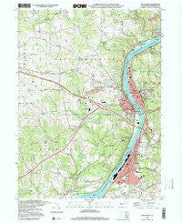
~ Kittanning PA topo map, 1:24000 scale, 7.5 X 7.5 Minute, Historical, 1998, updated 2000
Kittanning, Pennsylvania, USGS topographic map dated 1998.
Includes geographic coordinates (latitude and longitude). This topographic map is suitable for hiking, camping, and exploring, or framing it as a wall map.
Printed on-demand using high resolution imagery, on heavy weight and acid free paper, or alternatively on a variety of synthetic materials.
Topos available on paper, Waterproof, Poly, or Tyvek. Usually shipping rolled, unless combined with other folded maps in one order.
- Product Number: USGS-5324960
- Free digital map download (high-resolution, GeoPDF): Kittanning, Pennsylvania (file size: 14 MB)
- Map Size: please refer to the dimensions of the GeoPDF map above
- Weight (paper map): ca. 55 grams
- Map Type: POD USGS Topographic Map
- Map Series: HTMC
- Map Verison: Historical
- Cell ID: 23799
- Scan ID: 222934
- Imprint Year: 2000
- Woodland Tint: Yes
- Photo Inspection Year: 1998
- Aerial Photo Year: 1991
- Datum: NAD27
- Map Projection: Lambert Conformal Conic
- Map published by United States Geological Survey
- Map Language: English
- Scanner Resolution: 600 dpi
- Map Cell Name: Kittanning
- Grid size: 7.5 X 7.5 Minute
- Date on map: 1998
- Map Scale: 1:24000
- Geographical region: Pennsylvania, United States
Neighboring Maps:
All neighboring USGS topo maps are available for sale online at a variety of scales.
Spatial coverage:
Topo map Kittanning, Pennsylvania, covers the geographical area associated the following places:
- Ewing - Walkchalk - Dog Town - North Buffalo - Manor Heights - Pattonville - Ford Cliff - Furnace Run - McGrann - Ford City - Gosford - West Ford City - East Kittanning - Rosston - Garretts Run - Grandview - Wick City - Manorville - Pine Hill - Rossford - Fordview - Tarrtown - West Kittanning - Stringtown - Cadogan - McHaddon - Williamsburg - Lenape Heights - Applewold - Kittanning - West Hills - Center Hill - Sistersville
- Map Area ID: AREA40.87540.75-79.625-79.5
- Northwest corner Lat/Long code: USGSNW40.875-79.625
- Northeast corner Lat/Long code: USGSNE40.875-79.5
- Southwest corner Lat/Long code: USGSSW40.75-79.625
- Southeast corner Lat/Long code: USGSSE40.75-79.5
- Northern map edge Latitude: 40.875
- Southern map edge Latitude: 40.75
- Western map edge Longitude: -79.625
- Eastern map edge Longitude: -79.5


