
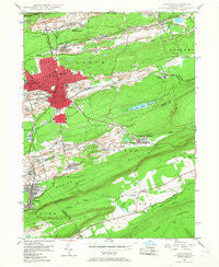
~ Hazleton PA topo map, 1:24000 scale, 7.5 X 7.5 Minute, Historical, 1947, updated 1967
Hazleton, Pennsylvania, USGS topographic map dated 1947.
Includes geographic coordinates (latitude and longitude). This topographic map is suitable for hiking, camping, and exploring, or framing it as a wall map.
Printed on-demand using high resolution imagery, on heavy weight and acid free paper, or alternatively on a variety of synthetic materials.
Topos available on paper, Waterproof, Poly, or Tyvek. Usually shipping rolled, unless combined with other folded maps in one order.
- Product Number: USGS-5324498
- Free digital map download (high-resolution, GeoPDF): Hazleton, Pennsylvania (file size: 10 MB)
- Map Size: please refer to the dimensions of the GeoPDF map above
- Weight (paper map): ca. 55 grams
- Map Type: POD USGS Topographic Map
- Map Series: HTMC
- Map Verison: Historical
- Cell ID: 19884
- Scan ID: 171945
- Imprint Year: 1967
- Woodland Tint: Yes
- Aerial Photo Year: 1942
- Field Check Year: 1947
- Datum: NAD27
- Map Projection: Polyconic
- Map published by United States Geological Survey
- Map Language: English
- Scanner Resolution: 600 dpi
- Map Cell Name: Hazleton
- Grid size: 7.5 X 7.5 Minute
- Date on map: 1947
- Map Scale: 1:24000
- Geographical region: Pennsylvania, United States
Neighboring Maps:
All neighboring USGS topo maps are available for sale online at a variety of scales.
Spatial coverage:
Topo map Hazleton, Pennsylvania, covers the geographical area associated the following places:
- Cranberry - Gerhards - McAdoo Heights - South Ebervale - Middletown - Milnesville - Junedale - Hazle Brook - New Silver Brook - Oakdale - Drifton - Mount Laurel - Coxes Village - Jeansville - Hazleton - Hazleton Station - Ebervale - McAdoo - Harleigh - Tresckow - Beaver Meadows - Japan - Old Sugar Loaf - Frenchtown - Leviston - Jeddo - West Hazleton - Hollywood - Beaver Brook - Lattimer - Audenried - Slykerville - Foundryville (historical)
- Map Area ID: AREA4140.875-76-75.875
- Northwest corner Lat/Long code: USGSNW41-76
- Northeast corner Lat/Long code: USGSNE41-75.875
- Southwest corner Lat/Long code: USGSSW40.875-76
- Southeast corner Lat/Long code: USGSSE40.875-75.875
- Northern map edge Latitude: 41
- Southern map edge Latitude: 40.875
- Western map edge Longitude: -76
- Eastern map edge Longitude: -75.875


